پرونده:AK01 109.png
تفکیکپذیری بالاتری در دسترس نیست.
AK01_109.png (۷۲۵ × ۳۹۰ پیکسل، اندازهٔ پرونده: ۳۱ کیلوبایت، نوع MIME پرونده: image/png)
این پرونده در ویکیانبار موجود است. محتویات صفحهٔ توصیف آن در زیر نمایش داده میشود. |
Transwiki approved by: w:en:User:Dmcdevit
This image was copied from wikipedia:en. The original description was:
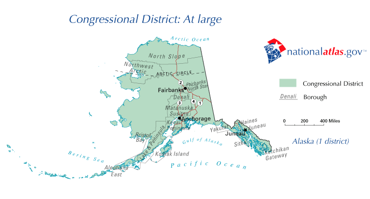
خلاصه
Map of Alaska's at-large Congressional district, from the National Atlas archive copy at the Wayback Machine
اجازهنامه
This map was obtained from an edition of the National Atlas of the United States. Like almost all works of the U.S. federal government, works from the National Atlas are in the public domain in the United States.
Online access: NationalAtlas.gov | 1970 print edition: Library of Congress, Perry-Castañeda Library
|
w:en:Category:Congressional district maps of the 109th Congress
سیاهه بارگذاری اصلی
| date/time | username | resolution | size | edit summary |
|---|---|---|---|---|
| 02:02, 17 June 2006 | w:en:User:Zero Gravitas | 725×390 | 25 KB | Map of Alaska's at-large Congressional district, from the National Atlas - [http://www.nationalatlas.gov] {{PD-USGov-Atlas}} |
Image description page history
| link | date/time | username | edit summary |
|---|---|---|---|
| http://en.wikipedia.org/w/index.php?title=Image:AK01_109.gif&redirect=no&oldid=65346328 | 07:27, 10 September 2007 | w:en:User:Dmcdevit | |
| http://en.wikipedia.org/w/index.php?title=Image:AK01_109.gif&redirect=no&oldid=65346328 | 08:19, 23 July 2006 | w:en:User:Markles | |
| http://en.wikipedia.org/w/index.php?title=Image:AK01_109.gif&redirect=no&oldid=59044388 | 02:03, 17 June 2006 | w:en:User:Zero Gravitas | |
| http://en.wikipedia.org/w/index.php?title=Image:AK01_109.gif&redirect=no&oldid=59044298 | 02:02, 17 June 2006 | w:en:User:Zero Gravitas | (Map of Alaska's at-large Congressional district, from the National Atlas - [http://www.nationalatlas.gov] {{PD-USGov-Atlas}}) |
سیاهه بارگذاری اصلی
| تاریخ/زمان | ابعاد | کاربر | توضیح |
|---|---|---|---|
| ۱۰ سپتامبر ۲۰۰۷, ۱۸:۴۱:۱۷ | 725 × 390 (25094 bytes) | BetacommandBot (بحث · مشارکتها) | Transwiki approved by: [[w:en:User:Dmcdevit]] This image was copied from wikipedia:en. The original description was: == Summary == Map of Alaska's at-large Congressional district, from the [http://www.nationalatlas.gov National Atlas] == Licensing == {{ |
تاریخچهٔ پرونده
روی تاریخ/زمانها کلیک کنید تا نسخهٔ مربوط به آن هنگام را ببینید.
| تاریخ/زمان | بندانگشتی | ابعاد | کاربر | توضیح | |
|---|---|---|---|---|---|
| کنونی | ۴ اوت ۲۰۱۴، ساعت ۱۴:۳۰ | | ۷۲۵ در ۳۹۰ (۳۱ کیلوبایت) | GifTagger | Bot: Converting file to superior PNG file. (Source: AK01_109.gif). This GIF was problematic due to non-greyscale color table. |
کاربرد پرونده
صفحههای زیر از این تصویر استفاده میکنند:
کاربرد سراسری پرونده
ویکیهای دیگر زیر از این پرونده استفاده میکنند:
- کاربرد در ca.wikipedia.org
- کاربرد در de.wikipedia.org
- کاربرد در en.wikipedia.org
- کاربرد در es.wikipedia.org
- کاربرد در fr.wikipedia.org
- کاربرد در hu.wikipedia.org
- کاربرد در it.wikipedia.org
- کاربرد در ja.wikipedia.org
- کاربرد در nl.wikipedia.org
- کاربرد در pt.wikipedia.org
- کاربرد در ru.wikipedia.org
- کاربرد در simple.wikipedia.org
- کاربرد در uk.wikipedia.org
- کاربرد در www.wikidata.org
- کاربرد در zh.wikipedia.org