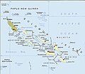
پرونده:Political map of the Solomon Islands archipelago in 1989.jpg

اندازهٔ این پیشنمایش: ۶۹۰ × ۶۰۰ پیکسل. کیفیتهای دیگر: ۲۷۶ × ۲۴۰ پیکسل | ۵۵۲ × ۴۸۰ پیکسل | ۷۴۸ × ۶۵۰ پیکسل.
پروندهٔ اصلی (۷۴۸ × ۶۵۰ پیکسل، اندازهٔ پرونده: ۷۲ کیلوبایت، نوع MIME پرونده: image/jpeg)
تاریخچهٔ پرونده
روی تاریخ/زمانها کلیک کنید تا نسخهٔ مربوط به آن هنگام را ببینید.
| تاریخ/زمان | بندانگشتی | ابعاد | کاربر | توضیح | |
|---|---|---|---|---|---|
| کنونی | ۱۲ آوریل ۲۰۱۶، ساعت ۰۲:۰۶ |  | ۷۴۸ در ۶۵۰ (۷۲ کیلوبایت) | Nimbosa | Reverted to version as of 02:02, 12 April 2016 (UTC) |
| ۱۲ آوریل ۲۰۱۶، ساعت ۰۲:۰۵ |  | ۷۴۸ در ۶۵۰ (۷۲ کیلوبایت) | Nimbosa | restored to original color as on print, corrected color map | |
| ۱۲ آوریل ۲۰۱۶، ساعت ۰۲:۰۲ |  | ۷۴۸ در ۶۵۰ (۷۲ کیلوبایت) | Nimbosa | restored to original color as on print, corrected color map | |
| ۱ مارس ۲۰۰۷، ساعت ۲۱:۰۹ |  | ۷۴۸ در ۶۵۰ (۷۲ کیلوبایت) | Pibwl |
کاربرد پرونده
صفحهٔ زیر از این تصویر استفاده میکند:
کاربرد سراسری پرونده
ویکیهای دیگر زیر از این پرونده استفاده میکنند:
- کاربرد در als.wikipedia.org
- کاربرد در ami.wikipedia.org
- کاربرد در ast.wikipedia.org
- کاربرد در bg.wikipedia.org
- کاربرد در bn.wikipedia.org
- کاربرد در ca.wikipedia.org
- کاربرد در ceb.wikipedia.org
- کاربرد در cs.wikipedia.org
- کاربرد در da.wikipedia.org
- کاربرد در el.wikipedia.org
- کاربرد در en.wikipedia.org
- کاربرد در en.wiktionary.org
- کاربرد در es.wikipedia.org
- کاربرد در fi.wikipedia.org
- کاربرد در fr.wikipedia.org
- کاربرد در gl.wikipedia.org
- کاربرد در hu.wikipedia.org
- کاربرد در hy.wikipedia.org
- کاربرد در hyw.wikipedia.org
- کاربرد در id.wikipedia.org
- کاربرد در it.wikipedia.org
- کاربرد در ja.wikipedia.org
- کاربرد در ja.wiktionary.org
- کاربرد در ka.wikipedia.org
- کاربرد در kk.wikipedia.org
نمایش استفادههای سراسری از این پرونده.


