پرونده:Sahara dust plume Nov 1998.jpg

اندازهٔ این پیشنمایش: ۸۰۰ × ۵۶۷ پیکسل. کیفیتهای دیگر: ۳۲۰ × ۲۲۷ پیکسل | ۶۴۰ × ۴۵۴ پیکسل | ۱٬۰۲۴ × ۷۲۶ پیکسل | ۱٬۲۸۰ × ۹۰۸ پیکسل | ۲٬۵۶۰ × ۱٬۸۱۶ پیکسل | ۴٬۴۴۹ × ۳٬۱۵۶ پیکسل.
پروندهٔ اصلی (۴٬۴۴۹ × ۳٬۱۵۶ پیکسل، اندازهٔ پرونده: ۵٫۰۶ مگابایت، نوع MIME پرونده: image/jpeg)
این پرونده در ویکیانبار موجود است. محتویات صفحهٔ توصیف آن در زیر نمایش داده میشود. |
خلاصه
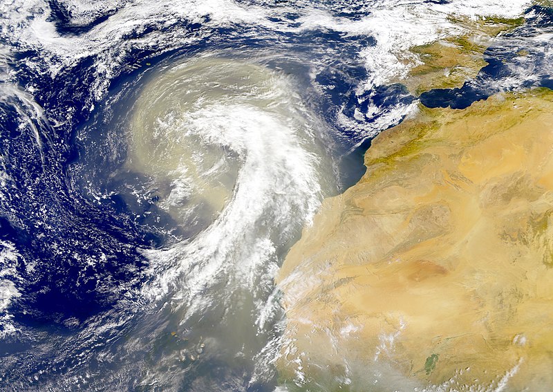
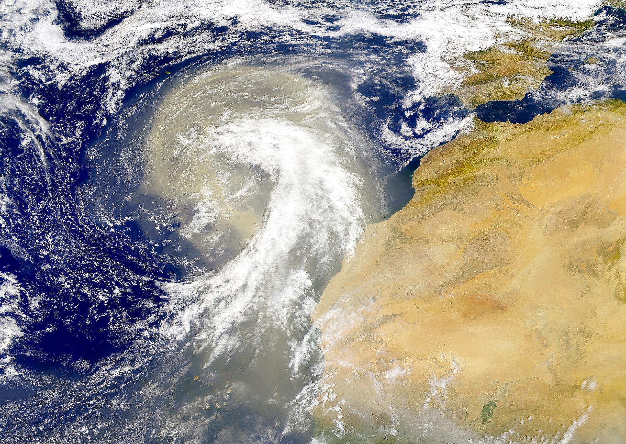
| توضیح | Dust plume off the Sahara desert over the northeast Atlantic Ocean. The Azores are visible at the northwest edge of the dust plume in this SeaWiFS image. The Cape Verde Islands can be seen through the dust near the bottom of the image. Sensor: OrbView-2/SeaWiFS |
| تاریخ | |
| منبع | NASA Visible Earth |
| پدیدآور | Provided by the SeaWiFS Project, NASA/Goddard Space Flight Center, and ORBIMAGE |
اجازهنامه
| This image is from the Sea-viewing Wide Field-of-view Sensor (SeaWiFS) Project and more than 5 years old.
Satellite data captured by the SeaWIFS sensor are released into the public domain 5 years after capture. Data less than five years old can be re-used only for educational or scientific purposes; any commercial use of such images must be coordinated with GeoEye. [1] |
| This work has been released into the public domain by its copyright holder, GeoEye. This applies worldwide. در برخی از کشورها ممکن است به صورت قانونی این امکانپذیر نباشد؛ اگر چنین است: GeoEye به هر کسی اجازهٔ استفاده از این اثر برای هر مقصودی، بدون هیچگونه شرایطی، را میدهد تا وقتی که این شرایط توسط قانون مستلزم نشده باشند.
|
تاریخچهٔ پرونده
روی تاریخ/زمانها کلیک کنید تا نسخهٔ مربوط به آن هنگام را ببینید.
| تاریخ/زمان | بندانگشتی | ابعاد | کاربر | توضیح | |
|---|---|---|---|---|---|
| کنونی | ۶ نوامبر ۲۰۰۵، ساعت ۰۰:۰۱ | | ۴٬۴۴۹ در ۳٬۱۵۶ (۵٫۰۶ مگابایت) | Tintazul | {{Information| |Description=Dust plume off the Sahara desert over the northeast Atlantic Ocean. The Azores are visible at the northwest edge of the dust plume in this SeaWiFS image. The Cape Verde Islands can be seen through the dust near the bottom of th |
کاربرد پرونده
صفحهٔ زیر از این تصویر استفاده میکند:
کاربرد سراسری پرونده
ویکیهای دیگر زیر از این پرونده استفاده میکنند:
- کاربرد در ar.wikipedia.org
- کاربرد در ast.wikipedia.org
- کاربرد در azb.wikipedia.org
- کاربرد در ca.wikipedia.org
- کاربرد در en.wikipedia.org
- کاربرد در en.wikivoyage.org
- کاربرد در eo.wikipedia.org
- کاربرد در es.wikipedia.org
- کاربرد در ga.wikipedia.org
- کاربرد در hu.wikipedia.org
- کاربرد در ko.wikipedia.org
- کاربرد در lt.wikipedia.org
- کاربرد در lv.wikipedia.org
- کاربرد در ml.wikipedia.org
- کاربرد در uk.wikipedia.org
- کاربرد در vi.wikipedia.org
- کاربرد در www.wikidata.org