پرونده:Western Ghana districts.png
پروندهٔ اصلی (۱٬۰۵۶ × ۸۱۶ پیکسل، اندازهٔ پرونده: ۴۵ کیلوبایت، نوع MIME پرونده: image/png)
این پرونده در ویکیانبار موجود است. محتویات صفحهٔ توصیف آن در زیر نمایش داده میشود. |

|
این locator map نگاره میبایست با استفاده از گرافیک برداری اسویجی فایل بازسازی شوند. این چند مزیت دارد؛ Commons:Media for cleanup را برای اطلاعات بیشتر ببینید. اگر حالت برداری آن در حال حاضر موجود است، لطفاً آن را بار کنید. پس از بارکردن یک اسویجی، این الگو را با {{vector version available|new image name.svg}} جایگزین کنید.
|
خلاصه
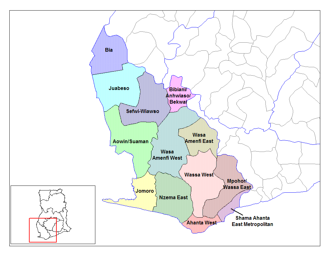
from en:districts of ghana Map of the districts of the Western region of Ghana. Created by Rarelibra for public domain use. Created using MapInfo Professional v7.5 and various mapping resources.
I, the creator of this work, hereby release it into the public domain. This applies worldwide. In case this is not legally possible, I grant any entity the right to use this work for any purpose, without any conditions, unless such conditions are required by law.
* (del) (cur) 08:09, 5 March 2006 . . Rarelibra (Talk | contribs) . . 1056x816 (45,897 bytes) (Map of the districts of the Western region of Ghana. Created by Rarelibra for public domain use. Created using MapInfo Professional v7.5 and various mapping resources.)
Created by Rarelibra for public domain use
اجازهنامه
| من، دارنده حق تکثیر این اثر، این اثر را به مالکیت عمومی منتشر میکنم. این قابل اجرا در تمام نقاط جهان است. در برخی از کشورها ممکن است به صورت قانونی این امکانپذیر نباشد؛ اگر چنین است: من اجازهٔ استفاده از این اثر را برای هر مقصودی، بدون هیچگونه شرایطی میدهم، تا وقتی که این شرایط توسط قانون مستلزم نشده باشد. |
تاریخچهٔ پرونده
روی تاریخ/زمانها کلیک کنید تا نسخهٔ مربوط به آن هنگام را ببینید.
| تاریخ/زمان | بندانگشتی | ابعاد | کاربر | توضیح | |
|---|---|---|---|---|---|
| کنونی | ۲۸ ژوئن ۲۰۰۶، ساعت ۱۴:۰۴ | | ۱٬۰۵۶ در ۸۱۶ (۴۵ کیلوبایت) | Ahanta | from en:districts of ghana Map of the districts of the Western region of Ghana. Created by Rarelibra for public domain use. Created using MapInfo Professional v7.5 and various mapping resources. I, the creator of this work, hereby release it into the pub |
کاربرد پرونده
صفحهٔ زیر از این تصویر استفاده میکند:
کاربرد سراسری پرونده
ویکیهای دیگر زیر از این پرونده استفاده میکنند:
- کاربرد در ca.wikipedia.org
- کاربرد در ceb.wikipedia.org
- کاربرد در dag.wikipedia.org
- کاربرد در de.wikipedia.org
- کاربرد در en.wikipedia.org
- Aowin/Suaman District
- Shama Ahanta East Metropolitan District
- Wassa West District
- User talk:Rarelibra/Maps2
- List of hospitals in Ghana
- Bia District
- List of Ghana Parliament constituencies
- User:GerardM/Districts of Ghana
- Mpohor/Wassa East District
- Wassa Amenfi District
- Juaboso-Bodi District
- Juaboso-Bia District
- Nzema District
- Sekondi Takoradi Metropolitan Authority
- Wassa-Fiase-Mpohor District
- Aowin-Amenfi District
- Sefwi-Bibiani District
- کاربرد در eo.wikipedia.org
- کاربرد در es.wikipedia.org
- کاربرد در frr.wikipedia.org
- کاربرد در fr.wikipedia.org
- کاربرد در gpe.wikipedia.org
- کاربرد در ha.wikipedia.org
- کاربرد در it.wikipedia.org
- کاربرد در ja.wikipedia.org
- کاربرد در ko.wikipedia.org
- کاربرد در la.wikipedia.org
- کاربرد در nl.wikipedia.org
- کاربرد در pl.wikipedia.org
نمایش استفادههای سراسری از این پرونده.