پرونده:Cheshire UK locator map 2010.svg

حجم پیشنمایش PNG این SVG file:۴۹۴ × ۶۰۰ پیکسل کیفیتهای دیگر: ۱۹۸ × ۲۴۰ پیکسل | ۳۹۵ × ۴۸۰ پیکسل | ۶۳۳ × ۷۶۸ پیکسل | ۸۴۳ × ۱٬۰۲۴ پیکسل | ۱٬۶۸۷ × ۲٬۰۴۸ پیکسل | ۱٬۱۰۸ × ۱٬۳۴۵ پیکسل.
پروندهٔ اصلی (پروندهٔ اسویجی، با ابعاد ۱٬۱۰۸ × ۱٬۳۴۵ پیکسل، اندازهٔ پرونده: ۳۰۲ کیلوبایت)
این پرونده در ویکیانبار موجود است. محتویات صفحهٔ توصیف آن در زیر نمایش داده میشود. |
خلاصه
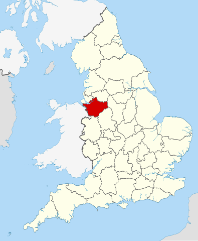
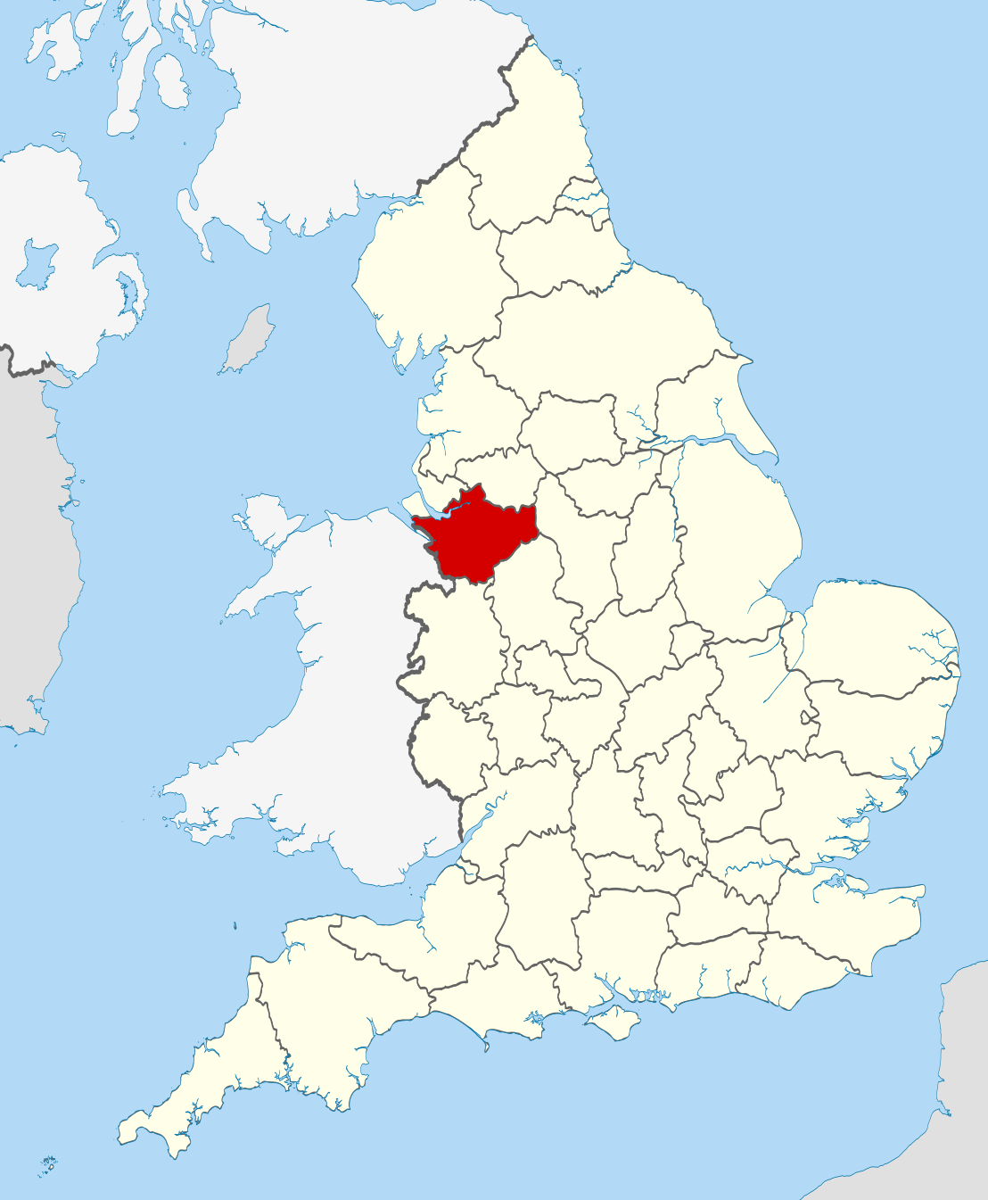
| توضیح | Location of the ceremonial county of Cheshire within England. |
| تاریخ | |
| منبع |
National Geospatial-Intelligence Agency
|
| پدیدآور | Nilfanion |
اجازهنامه
من، صاحب حقوق قانونی این اثر، به این وسیله این اثر را تحث اجازهنامههای ذیل منتشر میکنم:
این پرونده با اجازهنامهٔ کریتیو کامانز Attribution-Share Alike 3.0 سازگار نشده منتشر شده است.
- شما اجازه دارید:
- برای به اشتراک گذاشتن – برای کپی، توزیع و انتقال اثر
- تلفیق کردن – برای انطباق اثر
- تحت شرایط زیر:
- انتساب – شما باید اعتبار مربوطه را به دست آورید، پیوندی به مجوز ارائه دهید و نشان دهید که آیا تغییرات ایجاد شدهاند یا خیر. شما ممکن است این کار را به هر روش منطقی انجام دهید، اما نه به هر شیوهای که پیشنهاد میکند که مجوزدهنده از شما یا استفادهتان حمایت کند.
- انتشار مشابه – اگر این اثر را تلفیق یا تبدیل میکنید، یا بر پایه آن اثری دیگر خلق میکنید، میبایست مشارکتهای خود را تحت مجوز یکسان یا مشابه با ا اصل آن توزیع کنید.

|
اجازهٔ کپی، پخش و/یا تغییر این سند تحت شرایط مجوز مستندات آزاد گنو، نسخهٔ ۱٫۲ یا هر نسخهٔ بعدتری که توسط بنیاد نرمافزار آزاد منتشر شده؛ بدون بخشهای ناوردا (نامتغیر)، متون روی جلد، و متون پشت جلد، اعطا میشود. یک کپی از مجوز در بخشی تحت عنوان مجوز مستندات آزاد گنو ضمیمه شده است. |
میتوانید مجوز دلخواه خود را برگزینید.

|
This is one of the images forming part of the Valued image set: Locator maps of the Ceremonial counties of England on Wikimedia Commons. The image set has been assessed under the valued image set criteria and is considered the most valued set on Commons within the scope:
Locator maps of the Ceremonial counties of England
You can see its nomination at Commons:Valued image candidates/Locator maps of English ceremonial counties. |
تاریخچهٔ پرونده
روی تاریخ/زمانها کلیک کنید تا نسخهٔ مربوط به آن هنگام را ببینید.
| تاریخ/زمان | بندانگشتی | ابعاد | کاربر | توضیح | |
|---|---|---|---|---|---|
| کنونی | ۲۳ نوامبر ۲۰۱۰، ساعت ۲۲:۳۱ | | ۱٬۱۰۸ در ۱٬۳۴۵ (۳۰۲ کیلوبایت) | Nilfanion | == Summary == {{Information |Description=Location of the ceremonial county of Cheshire within England. |Source=Ordnance Survey [https://www.ordnancesurvey.co.uk/opendatadownload/products.html OpenData]: *County boundar |
کاربرد پرونده
صفحهٔ زیر از این تصویر استفاده میکند:
کاربرد سراسری پرونده
ویکیهای دیگر زیر از این پرونده استفاده میکنند:
- کاربرد در af.wikipedia.org
- کاربرد در an.wikipedia.org
- کاربرد در ar.wikipedia.org
- کاربرد در arz.wikipedia.org
- کاربرد در ast.wikipedia.org
- کاربرد در be-tarask.wikipedia.org
- کاربرد در be.wikipedia.org
- کاربرد در bg.wikipedia.org
- کاربرد در br.wikipedia.org
- کاربرد در ca.wikipedia.org
- کاربرد در ceb.wikipedia.org
- کاربرد در cs.wikipedia.org
- کاربرد در de.wikipedia.org
- کاربرد در en.wikipedia.org
- Cheshire
- Gawsworth
- Langley, Cheshire
- Martinscroft
- Croft, Cheshire
- Birchwood Forest Park
- Culcheth Linear Park
- Lymm Dam
- Westy
- Bruche, Warrington
- Kerridge
- River Bollin
- Ollerton, Cheshire
- Wirral Hundred
- Tytherington, Cheshire
- Whiston Rural District
- Englesea-Brook
- Wilderspool
- Hermitage Green
- Lache
- Siddington, Cheshire
- Hough Green
- Ness Botanic Gardens
- Adlington, Cheshire
- Risley, Warrington
- River Lily
- Orford Park
- Chelford
- Template:Cheshire-geo-stub
- Agden, Cheshire West and Chester
- Agden, Cheshire East
- Aldersey
- Chester Castle (parish)
- Smallwood, Cheshire
- Cuddington Heath
نمایش استفادههای سراسری از این پرونده.