پرونده:Maglic.jpg

اندازهٔ این پیشنمایش: ۸۰۰ × ۶۰۰ پیکسل. کیفیتهای دیگر: ۳۲۰ × ۲۴۰ پیکسل | ۶۴۰ × ۴۸۰ پیکسل | ۱٬۰۲۴ × ۷۶۸ پیکسل.
پروندهٔ اصلی (۱٬۰۲۴ × ۷۶۸ پیکسل، اندازهٔ پرونده: ۲۱۲ کیلوبایت، نوع MIME پرونده: image/jpeg)
این پرونده در ویکیانبار موجود است. محتویات صفحهٔ توصیف آن در زیر نمایش داده میشود. |
| مختصات دوربین | | محل قرارگیری این نگاره و سایر نگارهها در: نقشهٔ شهری باز |
|---|
| توضیح |
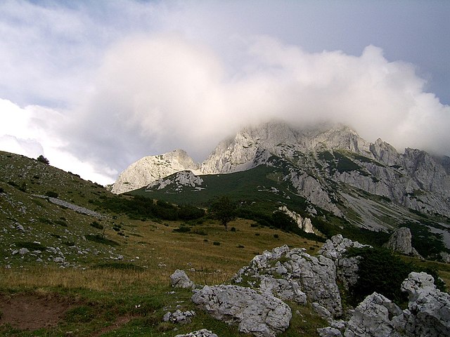
English: Maglić - the highest peak of Bosnia&Herzegovina Polski: Maglić - najwyższy szczyt Bośni i Hercegowiny Bosanski: Maglić - najviši planinski vrh Bosne i Hercegovine Українська: Гора Маґлич, Боснія та Герцеговина |
| تاریخ | |
| منبع | اثر شخصی |
| پدیدآور | Radosław Botev |
| اجازهنامه (استفادهٔ مجدد از این پرونده) |
This image is copyrighted by Radosław Botev. Permission is granted to use this picture freely for any purpose - whether commercial or not - and to make derivative works provided that the copyright holder's full name is quoted. You are also hereby permitted to redistribute this file and its derivations to a third party under any license of your choice as long as that license requires attribution to the copyright holder of this work and does not allow to ever revoke that requirement (possible examples are Creative Commons Attribution or GFDL). This shall by no means limit the right of the redistributor of this work or the right of the derivative works' creators to impose other restrictions on the use or further redistribution of this work or its derivations. English français polski +/- |
من، صاحب حقوق قانونی این اثر، به این وسیله این اثر را تحث اجازهنامهٔ ذیل منتشر میکنم:

|
دارندهٔ حقتکثیر این پرونده به هر کسی اجازهٔ استفاده از آن را به هر منظوری میدهد، به شرط آنکه به شکلی مناسب به دارندهٔ حقتکثیر نسبت داده شود. توزیع مجدد، آثار مشتقشده، استفادهٔ تجاری، و تمام استفادههای دیگر مجاز است. |
|
|
English: This file was originally published under one of the following licenses: Creative Commons Attribution ShareAlike 2.5 Poland or Creative Commons Attribution 2.5 Poland and was later relicensed by its creator Radosław Botev. The current license is less restrictive and still permits the use of this image under the original license. Polski: Ten plik był pierwotnie opublikowany na jednej z następujących licencji: Creative Commons Uznanie Autorstwa - Na tych samych warunkach 2.5 Polska lub Creative Commons Uznanie Autorstwa 2.5 Polska. Twórca tej pracy Radosław Botev zmienił później licencję. Obecna licencja jest mniej restrykcyjna i wciąż zezwala na wykorzystanie tej grafiki na zasadach przewidzianych w pierwotnej licencji.
|
تاریخچهٔ پرونده
روی تاریخ/زمانها کلیک کنید تا نسخهٔ مربوط به آن هنگام را ببینید.
| تاریخ/زمان | بندانگشتی | ابعاد | کاربر | توضیح | |
|---|---|---|---|---|---|
| کنونی | ۱۳ سپتامبر ۲۰۰۶، ساعت ۰۹:۵۰ | | ۱٬۰۲۴ در ۷۶۸ (۲۱۲ کیلوبایت) | Botev | {{Information |Description=Sutjeska National Park |Source= |Date=September, 2006 |Author=Botev |Permission=own work |other_versions= }} |
کاربرد پرونده
صفحهٔ زیر از این تصویر استفاده میکند:
کاربرد سراسری پرونده
ویکیهای دیگر زیر از این پرونده استفاده میکنند:
- کاربرد در ar.wikipedia.org
- کاربرد در azb.wikipedia.org
- کاربرد در be.wikipedia.org
- کاربرد در bg.wikipedia.org
- کاربرد در bs.wikipedia.org
- کاربرد در cs.wikipedia.org
- کاربرد در de.wikipedia.org
- کاربرد در eo.wikipedia.org
- کاربرد در es.wikipedia.org
- کاربرد در fr.wikipedia.org
- کاربرد در gl.wikipedia.org
- کاربرد در hr.wikipedia.org
- کاربرد در id.wikipedia.org
- کاربرد در it.wikipedia.org
- کاربرد در lmo.wikipedia.org
- کاربرد در lt.wikipedia.org
- کاربرد در mk.wikipedia.org
- کاربرد در mt.wikipedia.org
- کاربرد در nl.wikipedia.org
- کاربرد در no.wikipedia.org
- کاربرد در pl.wikipedia.org
- کاربرد در pt.wikipedia.org
- کاربرد در roa-rup.wikipedia.org
- کاربرد در ro.wikipedia.org
- کاربرد در ru.wikipedia.org
- کاربرد در sh.wikipedia.org
- کاربرد در sq.wikipedia.org
- کاربرد در sq.wikibooks.org
- کاربرد در sr.wikipedia.org
- کاربرد در uk.wikipedia.org
- کاربرد در vi.wikipedia.org
- کاربرد در www.wikidata.org