پرونده:Map of colonial Africa in 1897.jpg
پروندهٔ اصلی (۲٬۱۵۰ × ۱٬۶۶۸ پیکسل، اندازهٔ پرونده: ۱٫۳۷ مگابایت، نوع MIME پرونده: image/jpeg)
این پرونده در ویکیانبار موجود است. محتویات صفحهٔ توصیف آن در زیر نمایش داده میشود. |
| توضیح |
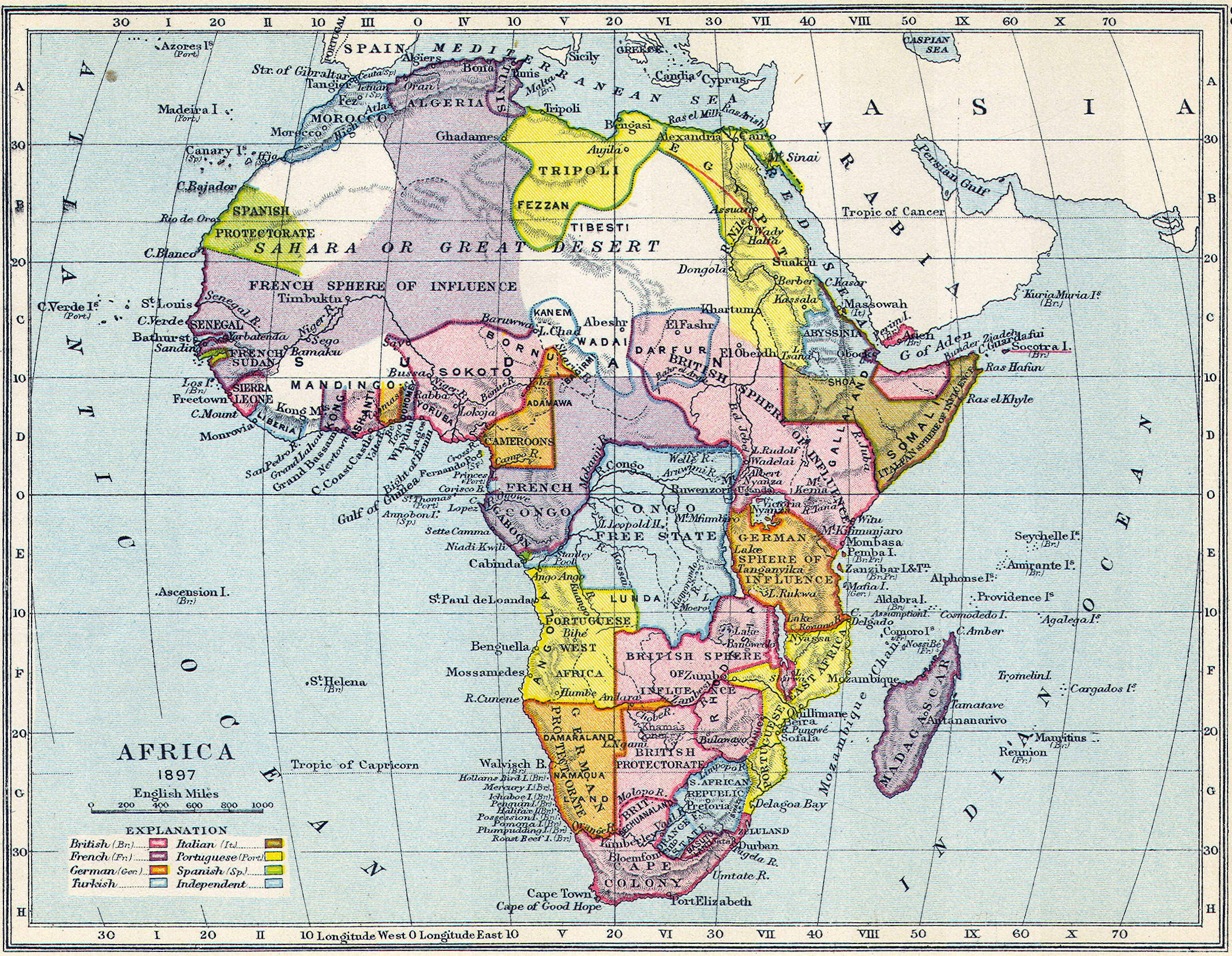
English: Map of colonial Africa in 1897. |
||||
| تاریخ | حوالی ۱۸۹۷ | ||||
| منبع | Scan of original | ||||
| پدیدآور | Gardiner's School Atlas of English History | ||||
| اجازهنامه (استفادهٔ مجدد از این پرونده) |
|
||||
تاریخچهٔ پرونده
روی تاریخ/زمانها کلیک کنید تا نسخهٔ مربوط به آن هنگام را ببینید.
| تاریخ/زمان | بندانگشتی | ابعاد | کاربر | توضیح | |
|---|---|---|---|---|---|
| کنونی | ۱ نوامبر ۲۰۱۳، ساعت ۰۹:۵۷ | | ۲٬۱۵۰ در ۱٬۶۶۸ (۱٫۳۷ مگابایت) | Philafrenzy | {{Information |Description ={{en|1=Map of colonial Africa in 1897.}} |Source =Scan of original |Author =Gardiner's School Atlas of English History |Date =c. 1897 |Permission ={{PD-Old}} |other_versions = }} [[Category:... |
کاربرد پرونده
صفحهٔ زیر از این تصویر استفاده میکند:
کاربرد سراسری پرونده
ویکیهای دیگر زیر از این پرونده استفاده میکنند:
- کاربرد در af.wikipedia.org
- کاربرد در af.wiktionary.org
- کاربرد در ar.wikipedia.org
- کاربرد در en.wikipedia.org
- کاربرد در it.wikipedia.org
- کاربرد در ja.wikipedia.org
- کاربرد در ps.wikipedia.org
- کاربرد در zh.wikipedia.org