پرونده:Maricopa County Incorporated and Planning areas Carefree highlighted.svg

حجم پیشنمایش PNG این SVG file:۶۹۴ × ۵۹۹ پیکسل کیفیتهای دیگر: ۲۷۸ × ۲۴۰ پیکسل | ۵۵۶ × ۴۸۰ پیکسل | ۸۸۹ × ۷۶۸ پیکسل | ۱٬۱۸۵ × ۱٬۰۲۴ پیکسل | ۲٬۳۷۱ × ۲٬۰۴۸ پیکسل | ۹۴۰ × ۸۱۲ پیکسل.
پروندهٔ اصلی (پروندهٔ اسویجی، با ابعاد ۹۴۰ × ۸۱۲ پیکسل، اندازهٔ پرونده: ۱٫۰۵ مگابایت)
این پرونده در ویکیانبار موجود است. محتویات صفحهٔ توصیف آن در زیر نمایش داده میشود. |
خلاصه
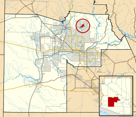
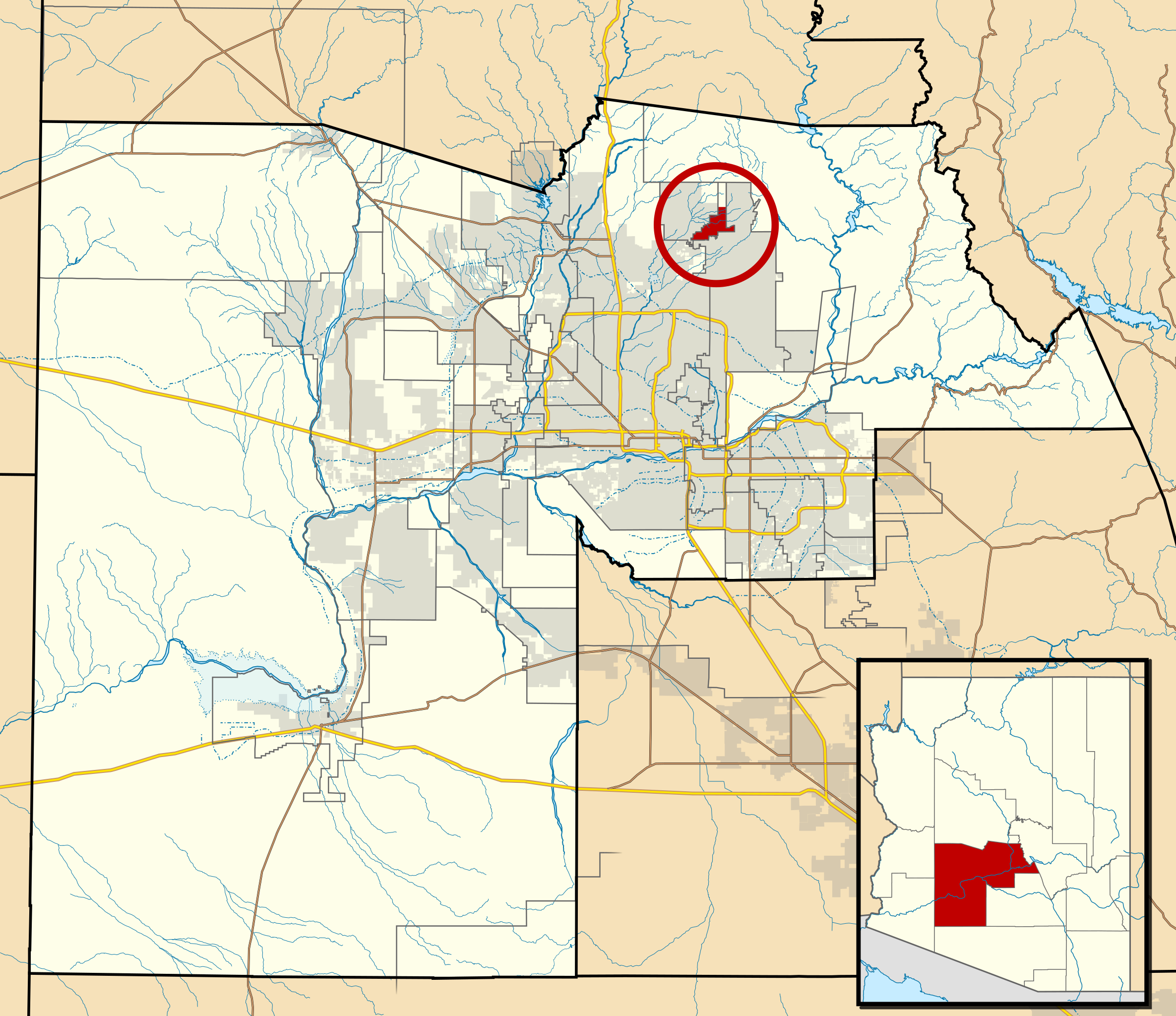
| توضیح | This map shows the incorporated areas and Indian reservation boundaries in Maricopa County, Arizona, along with water bodies and major highways and roads. Carefree is highlighted in red. Other incorporated cities are shown in gray, planning area borders for these cities and Indian reservation borders are shown as solid black lines. Changes from Previous Version: Updated the maps to include water bodies and to make "less boring" than the plain black/white/gray maps. Format was updated to match standards laid out by WikiProject Maps/Conventions. Map data is based on data from the following Webpage: Maricopa County Interactive GIS Map. I created this map in Inkscape. |
| تاریخ | |
| منبع | My own work, based on government information |
| پدیدآور | Ixnayonthetimmay |
| اجازهنامه (استفادهٔ مجدد از این پرونده) |
Public Domain |
| دیگر نسخهها | See Category:Maps of Maricopa County for other versions of this image. |
اجازهنامه
| من، دارنده حق تکثیر این اثر، این اثر را به مالکیت عمومی منتشر میکنم. این قابل اجرا در تمام نقاط جهان است. در برخی از کشورها ممکن است به صورت قانونی این امکانپذیر نباشد؛ اگر چنین است: من اجازهٔ استفاده از این اثر را برای هر مقصودی، بدون هیچگونه شرایطی میدهم، تا وقتی که این شرایط توسط قانون مستلزم نشده باشد. |
تاریخچهٔ پرونده
روی تاریخ/زمانها کلیک کنید تا نسخهٔ مربوط به آن هنگام را ببینید.
| تاریخ/زمان | بندانگشتی | ابعاد | کاربر | توضیح | |
|---|---|---|---|---|---|
| کنونی | ۲۰ مهٔ ۲۰۱۱، ساعت ۰۶:۱۱ | | ۹۴۰ در ۸۱۲ (۱٫۰۵ مگابایت) | Ixnayonthetimmay | Uploading new version |
| ۳۰ اوت ۲۰۰۸، ساعت ۰۳:۵۸ |  | ۹۰۰ در ۸۰۰ (۴۱۳ کیلوبایت) | Ixnayonthetimmay | == Summary == {{Information |Description=This map shows the incorporated areas and unincorporated areas in Maricopa County, Arizona. [[:en:Buckeye, Arizona|B | |
| ۱۶ سپتامبر ۲۰۰۷، ساعت ۰۰:۱۱ |  | ۹۰۰ در ۸۰۰ (۳۸۵ کیلوبایت) | Ixnayonthetimmay | {{Information |Description= |Source= |Date= |Author= |Permission= |other_versions= }} | |
| ۲۸ مهٔ ۲۰۰۷، ساعت ۰۹:۵۱ |  | ۹۰۰ در ۷۸۰ (۳۲۹ کیلوبایت) | Ixnayonthetimmay | ||
| ۲۱ مهٔ ۲۰۰۷، ساعت ۲۳:۵۱ |  | ۹۰۰ در ۷۸۰ (۳۱۸ کیلوبایت) | Ixnayonthetimmay | ||
| ۳۰ ژانویهٔ ۲۰۰۷، ساعت ۰۴:۵۴ |  | ۹۰۴ در ۷۵۸ (۱۷۷ کیلوبایت) | Ixnayonthetimmay | {{Information |Description=This map shows the incorporated areas in Maricopa County, Arizona, highlighting Carefree in red. It also shows the boundaries for the |
کاربرد پرونده
صفحهٔ زیر از این تصویر استفاده میکند:
کاربرد سراسری پرونده
ویکیهای دیگر زیر از این پرونده استفاده میکنند:
- کاربرد در ar.wikipedia.org
- کاربرد در arz.wikipedia.org
- کاربرد در ca.wikipedia.org
- کاربرد در cy.wikipedia.org
- کاربرد در de.wikipedia.org
- کاربرد در eu.wikipedia.org
- کاربرد در fr.wikipedia.org
- کاربرد در ht.wikipedia.org
- کاربرد در it.wikipedia.org
- کاربرد در ms.wikipedia.org
- کاربرد در pt.wikipedia.org
- کاربرد در sr.wikipedia.org
- کاربرد در tt.wikipedia.org
- کاربرد در www.wikidata.org
- کاربرد در zh-min-nan.wikipedia.org