پرونده:Missouri-Floyd Rivers Sioux City Iowa.jpg
اندازهٔ این پیشنمایش: ۸۰۰ × ۵۳۳ پیکسل. کیفیتهای دیگر: ۳۲۰ × ۲۱۳ پیکسل | ۶۴۰ × ۴۲۷ پیکسل | ۱٬۰۲۴ × ۶۸۳ پیکسل | ۱٬۵۰۰ × ۱٬۰۰۰ پیکسل.
پروندهٔ اصلی (۱٬۵۰۰ × ۱٬۰۰۰ پیکسل، اندازهٔ پرونده: ۷۱۱ کیلوبایت، نوع MIME پرونده: image/jpeg)
این پرونده در ویکیانبار موجود است. محتویات صفحهٔ توصیف آن در زیر نمایش داده میشود. |
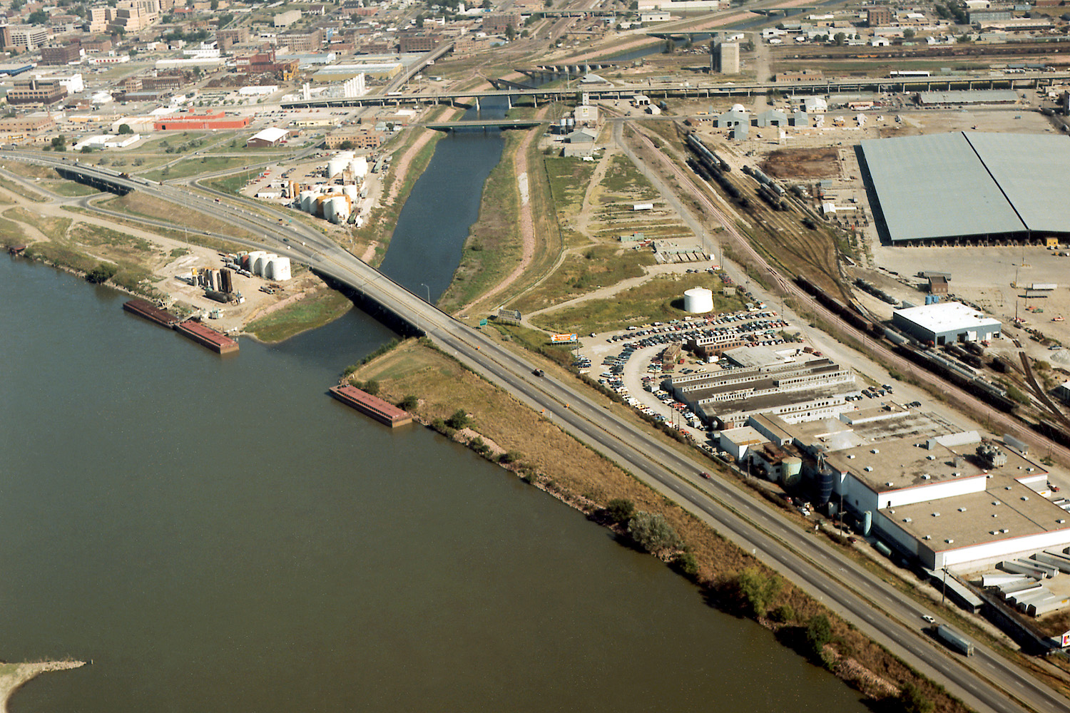
| توضیح | Aerial view of Sioux City, Iowa, USA, at the confluence of the Missouri and Floyd Rivers. Interstate-29 crosses the mouth of the Floyd River. | |||
| مکان | Sioux City, Iowa, USA 42°28′58.75″N 96°23′29.44″W / 42.4829861°N 96.3915111°W |
|||
| تاریخ | not specified | |||
| منبع |
U.S. Army Corps of Engineers Digital Visual Library Image page Image description page Digital Visual Library home page |
|||
| پدیدآور | Robert Etzel, U.S. Army Corps of Engineers | |||
| اجازهنامه (استفادهٔ مجدد از این پرونده) |
|
تاریخچهٔ پرونده
روی تاریخ/زمانها کلیک کنید تا نسخهٔ مربوط به آن هنگام را ببینید.
| تاریخ/زمان | بندانگشتی | ابعاد | کاربر | توضیح | |
|---|---|---|---|---|---|
| کنونی | ۱۹ مارس ۲۰۰۷، ساعت ۰۴:۲۳ | | ۱٬۵۰۰ در ۱٬۰۰۰ (۷۱۱ کیلوبایت) | DanMS | {{Information | Description = Aerial view of Sioux City, Iowa, USA, at the confluence of the Missouri and Floyd Rivers. Interstate-29 crosses the mouth of the Floyd River. | Source = U.S. Army Corps of Engineers Digital Visual Library<br />[http://im |
کاربرد پرونده
صفحهٔ زیر از این تصویر استفاده میکند:
کاربرد سراسری پرونده
ویکیهای دیگر زیر از این پرونده استفاده میکنند:
- کاربرد در arz.wikipedia.org
- کاربرد در ast.wikipedia.org
- کاربرد در ceb.wikipedia.org
- کاربرد در de.wikipedia.org
- کاربرد در en.wikipedia.org
- کاربرد در es.wikipedia.org
- کاربرد در fr.wikipedia.org
- کاربرد در gl.wikipedia.org
- کاربرد در incubator.wikimedia.org
- کاربرد در ja.wikipedia.org
- کاربرد در mr.wikipedia.org
- کاربرد در pt.wikipedia.org
- کاربرد در ru.wikipedia.org
- کاربرد در ta.wikipedia.org
- کاربرد در uk.wikipedia.org
- کاربرد در www.wikidata.org