پرونده:Nye fylker - regjeringen.no.svg

پروندهٔ اصلی (پروندهٔ اسویجی، با ابعاد ۵۱۵ × ۶۸۹ پیکسل، اندازهٔ پرونده: ۸۵ کیلوبایت)
این پرونده در ویکیانبار موجود است. محتویات صفحهٔ توصیف آن در زیر نمایش داده میشود. |
خلاصه
| توضیح |
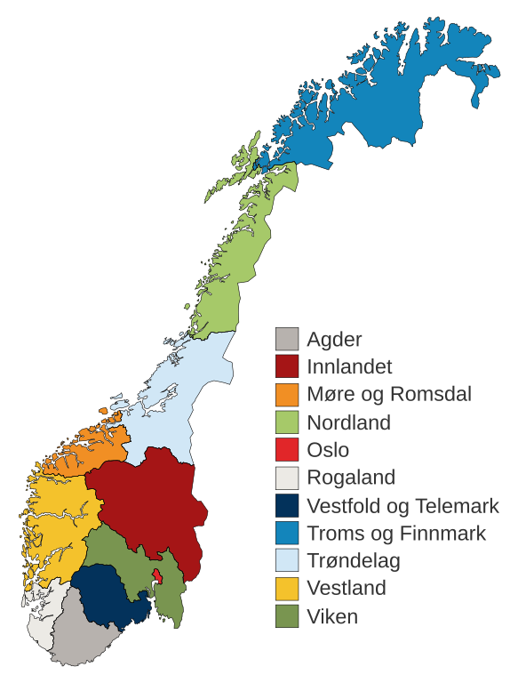
English: Municipal and regional reform: "On 8 June 2017, the Storting decided the following merger of counties". Illustration included.
Norsk bokmål: Kommune- og regionreform: "Stortinget vedtok 8. juni 2017 følgende sammenslåinger av fylker". Medfølgende kart-illustrasjon. |
|||
| تاریخ | ||||
| منبع |
این پرونده مشتق شدهاست از: Fylkeskart-regionreform.jpg |
|||
| پدیدآور | Furfur | |||
| اجازهنامه (استفادهٔ مجدد از این پرونده) |
|
|||
| دیگر نسخهها |
|
|||
| SVG genesis | کد مبدأ این پروندهٔ گرافیک برداری مقیاسپذیر، معتبر. این نقشهٔ جهان با Adobe Illustrator ساخته شده است |


تاریخچهٔ پرونده
روی تاریخ/زمانها کلیک کنید تا نسخهٔ مربوط به آن هنگام را ببینید.
| تاریخ/زمان | بندانگشتی | ابعاد | کاربر | توضیح | |
|---|---|---|---|---|---|
| کنونی | ۳ ژانویهٔ ۲۰۲۰، ساعت ۰۱:۵۴ | | ۵۱۵ در ۶۸۹ (۸۵ کیلوبایت) | Furfur | Korr. |
| ۳ ژانویهٔ ۲۰۲۰، ساعت ۰۱:۴۲ |  | ۵۱۵ در ۶۸۹ (۸۵ کیلوبایت) | Furfur | == {{int:filedesc}} == {{Information |Description={{User:Medium69/Traduction}} {{no|1=Kommune- og regionreform: "Stortinget vedtok 8. juni 2017 følgende sammenslåinger av fylker". Medfølgende kart-illustrasjon. }} |Source={{Derived from|Fylkeskart-regionreform.jpg}} *[https://www.regjeringen.no/no/tema/kommuner-og-regioner/regionreform/regionreform/nye-fylker/id2548426/ Nye fylker] |Date=2020-01-03 |Author={{U|Furfur}} |Permission={{self|GFDL|cc-by-sa-4.0}} |Other versions={{bva|Fylkeskart-re... |
کاربرد پرونده
صفحهٔ زیر از این تصویر استفاده میکند:
کاربرد سراسری پرونده
ویکیهای دیگر زیر از این پرونده استفاده میکنند:
- کاربرد در bs.wikipedia.org
- کاربرد در ca.wikipedia.org
- کاربرد در da.wikipedia.org
- کاربرد در el.wikipedia.org
- کاربرد در en.wikipedia.org
- کاربرد در es.wikipedia.org
- کاربرد در fi.wikipedia.org
- کاربرد در he.wikipedia.org
- کاربرد در hu.wikipedia.org
- کاربرد در is.wikipedia.org
- کاربرد در it.wikipedia.org
- کاربرد در jv.wikipedia.org
- کاربرد در ko.wikipedia.org
- کاربرد در nl.wikipedia.org
- کاربرد در nn.wikipedia.org
نمایش استفادههای سراسری از این پرونده.