پرونده:Australia Victoria Moorabool Shire location map.svg

حجم پیشنمایش PNG این SVG file:۵۳۳ × ۳۷۹ پیکسل کیفیتهای دیگر: ۳۲۰ × ۲۲۸ پیکسل | ۶۴۰ × ۴۵۵ پیکسل | ۱٬۰۲۴ × ۷۲۸ پیکسل | ۱٬۲۸۰ × ۹۱۰ پیکسل | ۲٬۵۶۰ × ۱٬۸۲۰ پیکسل.
پروندهٔ اصلی (پروندهٔ اسویجی، با ابعاد ۵۳۳ × ۳۷۹ پیکسل، اندازهٔ پرونده: ۴۹۱ کیلوبایت)
این پرونده در ویکیانبار موجود است. محتویات صفحهٔ توصیف آن در زیر نمایش داده میشود. |
| توضیح |
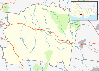
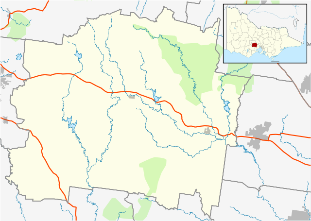
English: Blank map of w:Moorabool Shire, Victoria, Australia, with the following information shown:
Geographic limits:
|
||
| منبع | اثر شخصی + VicMap Lite | ||
| پدیدآور | Cassowary |

تاریخچهٔ پرونده
روی تاریخ/زمانها کلیک کنید تا نسخهٔ مربوط به آن هنگام را ببینید.
| تاریخ/زمان | بندانگشتی | ابعاد | کاربر | توضیح | |
|---|---|---|---|---|---|
| کنونی | ۲۰ فوریهٔ ۲۰۱۱، ساعت ۱۵:۳۵ | | ۵۳۳ در ۳۷۹ (۴۹۱ کیلوبایت) | Cassowary | {{Information |Description ={{en|1=Blank map of w:Moorabool Shire, Victoria, Australia, with the following information shown: * LGA boundaries * Coastline, lakes and rivers * Highways and freeways * Urban areas * Parks Geographic limits: * North: |
کاربرد پرونده
صفحهٔ زیر از این تصویر استفاده میکند:
کاربرد سراسری پرونده
ویکیهای دیگر زیر از این پرونده استفاده میکنند:
- کاربرد در ar.wikipedia.org
- کاربرد در ceb.wikipedia.org
- کاربرد در en.wikipedia.org
- Shire of Moorabool
- Bacchus Marsh
- Meredith, Victoria
- Trentham, Victoria
- Buninyong
- Ballan, Victoria
- Myrniong
- Scotsburn, Victoria
- Blackwood, Victoria
- Elaine, Victoria
- Gordon, Victoria
- Greendale, Victoria
- Wallace, Victoria
- Parwan, Victoria
- Mount Egerton, Victoria
- Template:Towns in Moorabool Shire
- Balliang, Victoria
- Lal Lal, Victoria
- Dunnstown, Victoria
- Beremboke, Victoria
- Bungaree, Victoria
- Barrys Reef, Victoria
- Darley, Victoria
- Warrenheip, Victoria
- Module:Location map/data/Australia Victoria Shire of Moorabool/doc
- Millbrook, Victoria
- Rowsley, Victoria
- Balliang East, Victoria
- Bullarook
- Yendon, Victoria
- Maddingley
- Clarkes Hill, Victoria
- Glenmore, Victoria
- Coimadai
- Clarendon, Victoria
- Hopetoun Park, Victoria
- Korobeit
- Leigh Creek, Victoria
- Morrisons, Victoria
- Spargo Creek, Victoria
- Springbank, Victoria
- Module:Location map/data/Australia Victoria Shire of Moorabool
- User:Viatori/sandbox
- User:ThylacineHunter/LGA
- کاربرد در ja.wikipedia.org
- کاربرد در kn.wikipedia.org
نمایش استفادههای سراسری از این پرونده.