پرونده:Caves on the Kabul River -b.jpg

اندازهٔ این پیشنمایش: ۸۰۰ × ۶۰۰ پیکسل. کیفیتهای دیگر: ۳۲۰ × ۲۴۰ پیکسل | ۶۴۰ × ۴۸۰ پیکسل | ۱٬۰۲۴ × ۷۶۸ پیکسل | ۱٬۲۸۰ × ۹۶۰ پیکسل | ۲٬۵۶۰ × ۱٬۹۲۰ پیکسل | ۳٬۴۵۶ × ۲٬۵۹۲ پیکسل.
پروندهٔ اصلی (۳٬۴۵۶ × ۲٬۵۹۲ پیکسل، اندازهٔ پرونده: ۴٫۰۸ مگابایت، نوع MIME پرونده: image/jpeg)
این پرونده در ویکیانبار موجود است. محتویات صفحهٔ توصیف آن در زیر نمایش داده میشود. |
| توضیح |
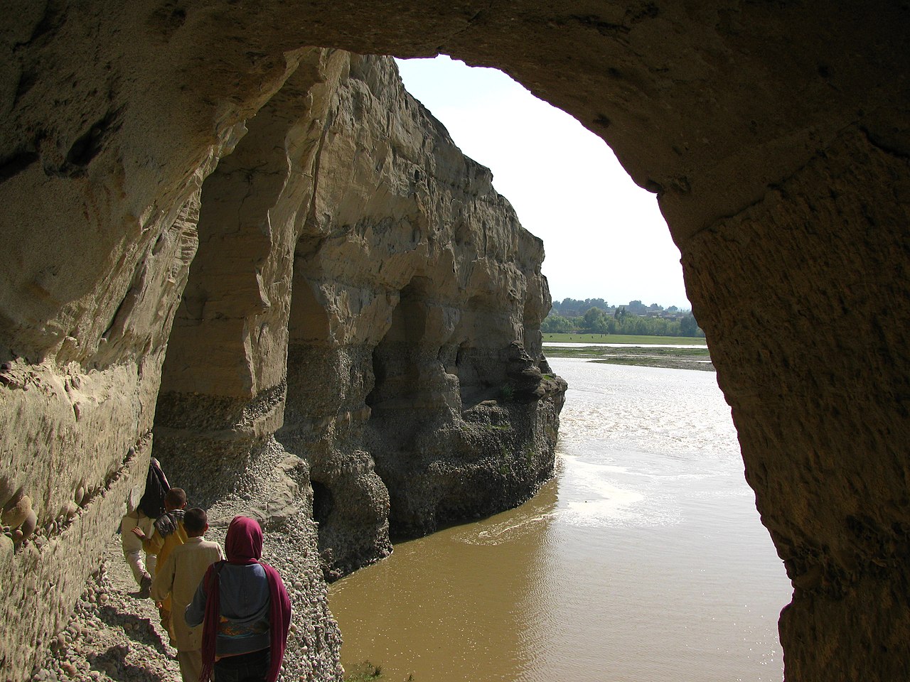
The following is the author's description of the photograph quoted directly from the photograph's Flickr page. "A view coming out of one of the caves of the Kabul River. Muddy and swollen, it's [sic] spring. ---- After visiting the village we went to the 'Buddhist Caves', which have been carved into a set of cliffs on the north side of the Kabul river. Interviews with locals yielded few results, they know virtually nothing about the pre-Islamic history of the country. These caves were part of a Buddhist monastery, and are significant because they were the home of part of the Edicts of Ashoka from around the year 272 BC probably put there by Devanampiya Tissa. The inscriptions are now in the Kabul Museum collection. The rest of the caves are completely looted. The only remains are the caves themselves, classic Buddhist 'hand' rock inscriptions, and the occasional remnants of stuccos or statues. In the year 629 the Chinese scholar Xuanzang visited the monastaries here and reported a 300 foot tall stupa. I'm not sure which stupa he is referring to of the ~37 in the area, but there is one above the caves which appears to be fairly elaborate. These caves also served in various wars over the years housing mujahadeen due to it's [sic] good lookout position and ready retreat routes. We found bullets embedded in various places. More information: en.wikipedia.org/wiki/Devanampiyatissa en.wikipedia.org/wiki/Ashoka_the_Great en.wikipedia.org/wiki/Edicts_of_Ashoka en.wikipedia.org/wiki/Xuanzang en.wikipedia.org/wiki/Stupa " |
||
| تاریخ | عکسبرداریشده در ۹ آوریل ۲۰۰۹ | ||
| منبع |
originally posted to Flickr as Kabul River
|
||
| پدیدآور | Todd Huffman | ||
| اجازهنامه (استفادهٔ مجدد از این پرونده) |
این پرونده با اجازهنامهٔ کریتیو کامانز Attribution 2.0 عمومی منتشر شده است.
|
| مختصات دوربین | | محل قرارگیری این نگاره و سایر نگارهها در: نقشهٔ شهری باز |
|---|
تاریخچهٔ پرونده
روی تاریخ/زمانها کلیک کنید تا نسخهٔ مربوط به آن هنگام را ببینید.
| تاریخ/زمان | بندانگشتی | ابعاد | کاربر | توضیح | |
|---|---|---|---|---|---|
| کنونی | ۷ اکتبر ۲۰۰۹، ساعت ۰۶:۲۳ | | ۳٬۴۵۶ در ۲٬۵۹۲ (۴٫۰۸ مگابایت) | Geo Swan | {{Information |Description=The following is the author's description of the photograph quoted directly from the photograph's Flickr page.<br/>"A view coming out of one of the caves of the Kabul River. Muddy and swollen, it's spring.<br><br>----<br><br>Af |
کاربرد پرونده
صفحهٔ زیر از این تصویر استفاده میکند:
کاربرد سراسری پرونده
ویکیهای دیگر زیر از این پرونده استفاده میکنند:
- کاربرد در en.wikipedia.org
- کاربرد در gu.wikipedia.org
- کاربرد در hi.wikipedia.org
- کاربرد در hy.wikipedia.org
- کاربرد در nl.wikipedia.org
- کاربرد در pa.wikipedia.org
- کاربرد در ru.wikipedia.org
- کاربرد در ta.wikipedia.org
- کاربرد در tg.wikipedia.org
- کاربرد در th.wikipedia.org
- کاربرد در uk.wikipedia.org