پرونده:Curtis and Cheeseman Islands from north.png

اندازهٔ این پیشنمایش: ۸۰۰ × ۱۷۰ پیکسل. کیفیت دیگر: ۱٬۰۵۰ × ۲۲۳ پیکسل.
پروندهٔ اصلی (۱٬۰۵۰ × ۲۲۳ پیکسل، اندازهٔ پرونده: ۳۱۷ کیلوبایت، نوع MIME پرونده: image/png)
این پرونده در ویکیانبار موجود است. محتویات صفحهٔ توصیف آن در زیر نمایش داده میشود. |
خلاصه
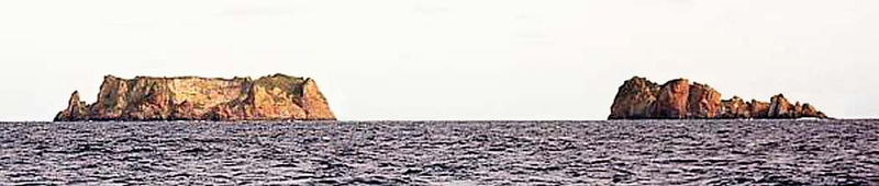
| توضیح |
English: Picture of Curtis and Cheeseman Islands, Kermadec Islands, north of New Zealand |
| تاریخ | |
| منبع | Sailing Directions (Enroute), Pub 127 Pacific West |
| پدیدآور | National Geospatial-Intelligence Agency |
اجازهنامه
This image is a work of the United States National Geospatial-Intelligence Agency or one of its predecessor agencies. As a work of the U.S. federal government, the image is in the public domain.
|
 |
تاریخچهٔ پرونده
روی تاریخ/زمانها کلیک کنید تا نسخهٔ مربوط به آن هنگام را ببینید.
| تاریخ/زمان | بندانگشتی | ابعاد | کاربر | توضیح | |
|---|---|---|---|---|---|
| کنونی | ۶ دسامبر ۲۰۰۹، ساعت ۲۱:۴۴ | ۱٬۰۵۰ در ۲۲۳ (۳۱۷ کیلوبایت) | Ratzer | {{Information |Description={{en|1=picture of Curtis and Cheeseman Islands, Kermadec Islands, north of New Zealand}} |Source=Sailing Directions (Enroute), Pub 127 Pacific West |Author=National Geospatial-Intelligence Agency |Date=2000 |Permission= |other_v |
کاربرد پرونده
صفحههای زیر از این تصویر استفاده میکنند:
کاربرد سراسری پرونده
ویکیهای دیگر زیر از این پرونده استفاده میکنند:
- کاربرد در ceb.wikipedia.org
- کاربرد در de.wikipedia.org
- کاربرد در en.wikipedia.org
- کاربرد در fr.wikipedia.org
- کاربرد در it.wikipedia.org
- کاربرد در www.wikidata.org
- کاربرد در zh.wikipedia.org