پرونده:Fernão Vaz Dourado 1571-1.jpg
پروندهٔ اصلی (۳٬۱۰۲ × ۲٬۳۸۱ پیکسل، اندازهٔ پرونده: ۵٫۸۲ مگابایت، نوع MIME پرونده: image/jpeg)
این پرونده در ویکیانبار موجود است. محتویات صفحهٔ توصیف آن در زیر نمایش داده میشود. |
|
This image was selected as picture of the day on Wikimedia Commons for 18 July 2008. It was captioned as follows: Other languages:
Bosanski: Zapadna Afrika na nautičkoj karti portugalskog kartografa Fernão-a Vaz Dourado-a, 1571. Čeština: Západní Afrika na mapě portugalského kartografa Fernão Vaz Dourado z roku 1571. Dansk: Vestafrika på et søkort af den portugisiske kartograf Fernão Vaz Dourado, 1571. Deutsch: Nautische Karte von Westafrika, gezeichnet 1571 vom portugiesischen Kartographen Fernão Vaz Dourado. Français : Carte nautique de Fernão Vaz Dourado (c. 1520 - c. 1580), extraite d'un atlas nautique tracé en 1571 et conservé dans les Archives Nationales Portugaises de Torre do Tombo, à Lisbonne. Íslenska: Vestur-Afríka á sjókorti eftir portúgalska kortagerðarmanninn Fernão Vaz Dourado frá 1571. Italiano: L'Africa occidentale in una carta nautica del cartografo portoghese Fernão Vaz Dourado, 1571. Magyar: Nyugat-Afrika portolántérképe, Fernão Vaz Dourado portugál térképész munkája (1571). A térkép egy tengerészeti atlaszhoz tartozott, jelenleg a Portugál Nemzeti Archívumban őrzik. Português: Uma carta náutica de Fernão Vaz Dourado, da África ocidental extraída do atlas náutico de 1571, pertencente ao Arquivo Nacional da Torre do Tombo, em Lisboa. Română: Hartă de navigație realizată de cartograful portughez Fernão Vaz Douradoî reprezentând regiunea Africii de vest. Svenska: Sjökort över Västafrikas kust, ritat av den portugisiske kartografen Fernão Vaz Dourado 1571. Беларуская: Заходняя Афрыка на марской карце партугальскага картографа Фернана Вас-Дурада (1571). Українська: Морська мапа Західної Африки португальського картографа Фернао Ваш Дораду (Fernão Vaz Dourado), 1571. मराठी: पश्चिमी अफ्रीका नकाशा, एक समुद्री पुर्तगाली मानचित्रकार फर्नॅव वाज डोराडो, इ.स. १५७१. 한국어: 포르투갈 지도 제작자 페르낭 바즈 도우라도가 1571년에 그린 서아프리카 해도. 中文: 费尔南·瓦斯·多拉多于1571年绘制的西非航海图 |
خلاصه
| Description |
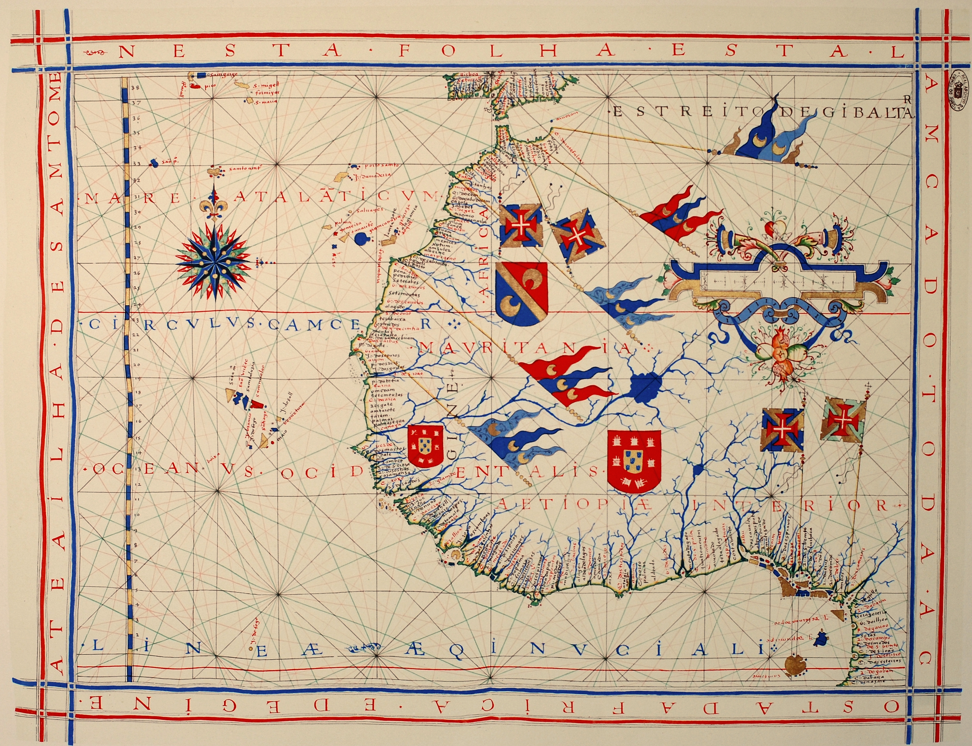
Português: Carta náutica de Fernão Vaz Dourado (c. 1520 - c. 1580), integrante de um atlas desenhado em 1571, atualmente no Arquivo Nacional da Torre do Tombo (ANTT) em Lisboa.
Deutsch: Westafrika, hier genannt Aetiopiae Interior. Seekarte aus einem Atlas von 1571 des portugiesischen Kartographen Fernão Vaz Dourado (ca. 1520 - ca. 1580). Nationalarchiv Torre do Tombo (ANTT) in Lissabon.
Nederlands: West-Afrika, hier genoemd Aetiopiae Interior. Zeekaart uit een atlas van 1571 van de Portugese cartograaf Fernão Vaz Dourado (ca. 1520 - ca. 1580). Nationaal archief Torre do Tombo (ANTT) in Lissabon.
English: Nautical chart of Portuguese cartographer Fernão Vaz Dourado (c. 1520 - c. 1580), part of a nautical atlas drawn in 1571 and now kept in the Portuguese National Archives of Torre do Tombo (ANTT), Lisbon.
Français : Carte nautique de Fernão Vaz Dourado (c. 1520 - c. 1580), extraite d'un atlas nautique tracé en 1571 et conservé dans les Archives Nationales Portugaises de Torre do Tombo (ANTT), à Lisbone. |
|||||||||
| تاریخ | Original work of 1571. Photo taken in 2008 | |||||||||
| منبع | اثر شخصی | |||||||||
| پدیدآورنده | ||||||||||
| Geotemporal data | ||||||||||
| Bounding box |
|
|||||||||
| Georeferencing | ||||||||||
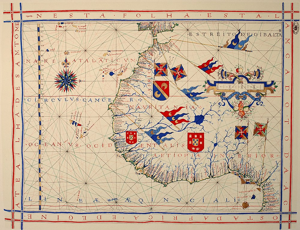
| دیگر نسخهها | آثار انشقاقی از این پرونده: Map of Arguin Bay, 1571 (detail).jpg | |||||||||
.jpg)
اجازهنامه
|
این اثر در کشورهایی و مناطقی که مدت زمان حق تکثیر، عمر پدیدآورنده بعلاوه 70 سال یا کمتر بعد از مرگ او است، در مالکیت عمومی قرار دارد.
| |
| این پرونده تحت قانون حق تکثیر محدودیت آزاد منتشر شده که شامل تمامی حقوق مربوطه و حقوق نزدیک به آن میشود. | |
تاریخچهٔ پرونده
روی تاریخ/زمانها کلیک کنید تا نسخهٔ مربوط به آن هنگام را ببینید.
| تاریخ/زمان | بندانگشتی | ابعاد | کاربر | توضیح | |
|---|---|---|---|---|---|
| کنونی | ۲۵ ژانویهٔ ۲۰۱۳، ساعت ۱۵:۱۶ | | ۳٬۱۰۲ در ۲٬۳۸۱ (۵٫۸۲ مگابایت) | Slick-o-bot | Bot: convert to a non-interlaced jpeg (see bug #17645) |
| ۶ مارس ۲۰۰۸، ساعت ۱۴:۴۲ |  | ۳٬۱۰۲ در ۲٬۳۸۱ (۵٫۳۲ مگابایت) | Alvesgaspar | {{Information |Description= |Source= |Date= |Author= |Permission= |other_versions= }} | |
| ۶ مارس ۲۰۰۸، ساعت ۰۹:۵۳ |  | ۳٬۰۷۹ در ۲٬۳۴۹ (۴٫۵۳ مگابایت) | Alvesgaspar | {{Information |Description=Nautical chart of Portuguese cartographer Fernão Vaz Dourado (c. 1520 - c. 1580), part of a nautical atlas drawn in 1571 and now kept in the Portuguese National Archives of Torre do Tombo, Lisbon. |Source=self-made |Date=Origin |
کاربرد پرونده
صفحهٔ زیر از این تصویر استفاده میکند:
کاربرد سراسری پرونده
ویکیهای دیگر زیر از این پرونده استفاده میکنند:
- کاربرد در af.wikipedia.org
- کاربرد در ar.wikipedia.org
- کاربرد در bn.wikipedia.org
- کاربرد در ca.wikipedia.org
- کاربرد در crh.wikipedia.org
- کاربرد در cv.wikipedia.org
- کاربرد در de.wikipedia.org
- کاربرد در el.wikipedia.org
- کاربرد در en.wikipedia.org
- Cartography
- History of Portugal (1415–1578)
- Nautical chart
- Conquistador
- Portal:Africa/Featured picture
- European exploration of Africa
- Portal talk:Africa/Featured picture
- User:Alvesgaspar
- Portal:Maps/Selected picture
- Wikipedia:Featured pictures thumbs/11
- Wikipedia:Featured picture candidates/March-2008
- Fernão Vaz Dourado
- Wikipedia:Featured picture candidates/Fernão Vaz Dourado nautical chart
- Wikipedia:Wikipedia Signpost/2008-03-17/Features and admins
- Portal:Africa/Featured picture/23
- Wikipedia:Featured pictures/Diagrams, drawings, and maps/Maps
- Wikipedia:Picture of the day/September 2008
- Wikipedia:Wikipedia Signpost/2008-03-17/SPV
- Template:POTD/2008-09-27
- Portal:Maps/Selected picture/36
- User:Peter Mercator/Draft for Mercator
- Battle of Guinea
- User talk:Alvesgaspar/archive1
- Iberian cartography, 1400–1600
- Portal:Geography/Selected picture
- Portuguese nautical science
- Portal:Geodesy
- Wikipedia:Wikipedia Signpost/Single/2008-03-17
- کاربرد در es.wikipedia.org
- کاربرد در eu.wikipedia.org
- کاربرد در fr.wikipedia.org
- کاربرد در he.wikipedia.org
- کاربرد در hu.wikipedia.org
- کاربرد در it.wikipedia.org
نمایش استفادههای سراسری از این پرونده.