پرونده:Intracoastal Waterway at Bayou Barataria.jpg
اندازهٔ این پیشنمایش: ۸۰۰ × ۵۳۳ پیکسل. کیفیتهای دیگر: ۳۲۰ × ۲۱۳ پیکسل | ۶۴۰ × ۴۲۷ پیکسل | ۱٬۰۲۴ × ۶۸۳ پیکسل | ۱٬۵۰۰ × ۱٬۰۰۰ پیکسل.
پروندهٔ اصلی (۱٬۵۰۰ × ۱٬۰۰۰ پیکسل، اندازهٔ پرونده: ۳۹۶ کیلوبایت، نوع MIME پرونده: image/jpeg)
این پرونده در ویکیانبار موجود است. محتویات صفحهٔ توصیف آن در زیر نمایش داده میشود. |
| توضیح |
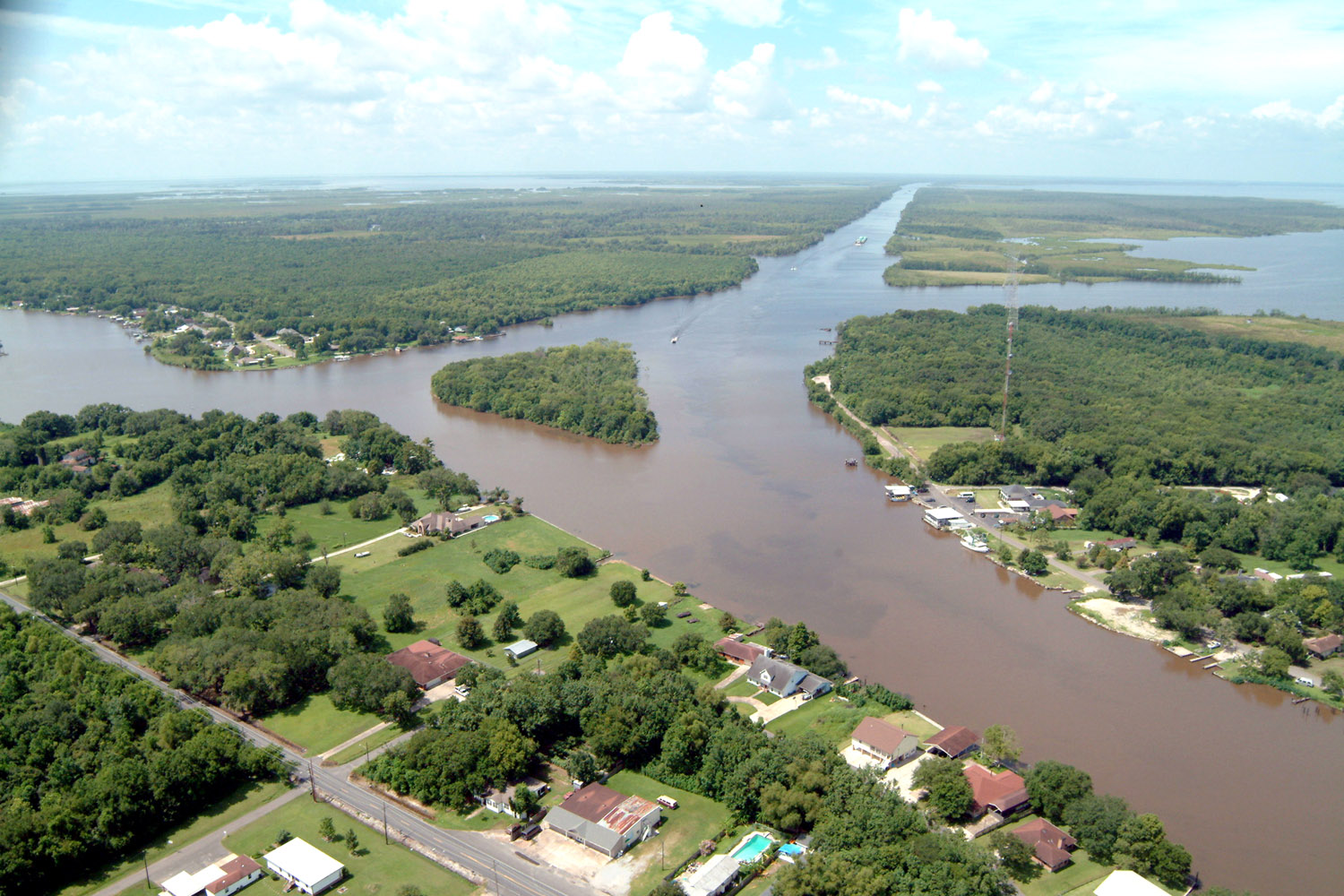
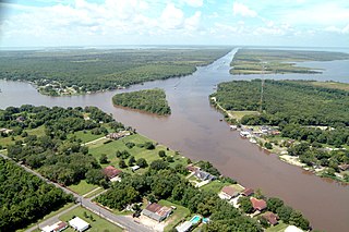
English: Aerial view of a northern section of Jean Lafitte, Louisiana at the Gulf Intracoastal Waterway (GIWW). The waterway stretches off to the southwest at the top of the picture and also turns right into the Bayou Villars and Lake Salvador at the right. Bayou Barataria runs off to the left. |
|||
| تاریخ | ||||
| منبع |
U.S. Army Corps of Engineers Digital Visual Library Image page Image description page Digital Visual Library home page |
|||
| پدیدآور | Lane Lefort, U.S. Army Corps of Engineers | |||
| اجازهنامه (استفادهٔ مجدد از این پرونده) |
|
|||
| مکان | Jefferson Parish, Louisiana |
| مختصات دوربین | | محل قرارگیری این نگاره و سایر نگارهها در: نقشهٔ شهری باز |
|---|
تاریخچهٔ پرونده
روی تاریخ/زمانها کلیک کنید تا نسخهٔ مربوط به آن هنگام را ببینید.
| تاریخ/زمان | بندانگشتی | ابعاد | کاربر | توضیح | |
|---|---|---|---|---|---|
| کنونی | ۷ آوریل ۲۰۰۷، ساعت ۲۳:۲۳ | | ۱٬۵۰۰ در ۱٬۰۰۰ (۳۹۶ کیلوبایت) | DanMS | {{Information | Description = {{en|Aerial view of a northern section of Jean Lafitte, Louisiana at the Gulf Intracoastal Waterway (GIWW). The waterway stretches off to the southwest at the top of the picture and also turns right into the Bayou Villars |
کاربرد پرونده
صفحهٔ زیر از این تصویر استفاده میکند:
کاربرد سراسری پرونده
ویکیهای دیگر زیر از این پرونده استفاده میکنند:
- کاربرد در ar.wikipedia.org
- کاربرد در arz.wikipedia.org
- کاربرد در azb.wikipedia.org
- کاربرد در ca.wikipedia.org
- کاربرد در ceb.wikipedia.org
- کاربرد در ce.wikipedia.org
- کاربرد در cy.wikipedia.org
- کاربرد در en.wikipedia.org
- کاربرد در en.wikivoyage.org
- کاربرد در es.wikipedia.org
- کاربرد در eu.wikipedia.org
- کاربرد در fr.wikipedia.org
- کاربرد در ht.wikipedia.org
- کاربرد در it.wikipedia.org
- کاربرد در lld.wikipedia.org
- کاربرد در nl.wikipedia.org
- کاربرد در pl.wikipedia.org
- کاربرد در pt.wikipedia.org
- کاربرد در sh.wikipedia.org
- کاربرد در sr.wikipedia.org
- کاربرد در tt.wikipedia.org
- کاربرد در uk.wikipedia.org
- کاربرد در www.wikidata.org
- کاربرد در zh-min-nan.wikipedia.org