پرونده:Konstanz - 27-48.jpg

پروندهٔ اصلی (۳٬۳۸۸ × ۴٬۹۹۵ پیکسل، اندازهٔ پرونده: ۳٫۴۷ مگابایت، نوع MIME پرونده: image/jpeg)
این پرونده در ویکیانبار موجود است. محتویات صفحهٔ توصیف آن در زیر نمایش داده میشود. |
|
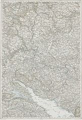
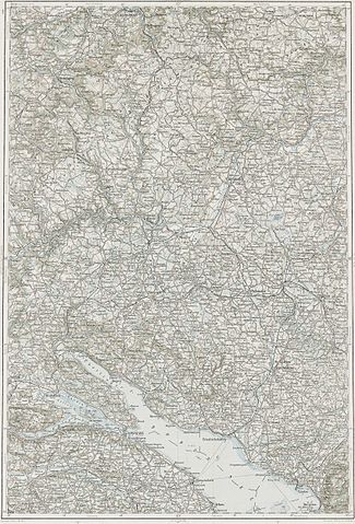
Deutsch: Blatt 27-48 der Generalkarte von Mitteleuropa 1:200.000 der Franzisco-Josephinischen Landesaufnahme, Österreich-Ungarn, ab 1887. Die Blattmitte liegt bei 48° n.Br. und 27° ö.L. (östlich von Ferro, nicht Greenwich!). English: Sheet 27-48 of the General Map of Central Europe, scale 1:200,000, edited 1887 ff. See 3rd Military Mapping Survey of Austria-Hungary for details. The center of the sheet is 48° North, 27° East (east of Ferro, not Greenwich!).
← Nachbarblätter. Klicken Sie auf eine Miniatur, um zu diesem Blatt zu gelangen.
← Neighbouring sheets. Click thumbnail to navigate |


.jpg)
خلاصه
| توضیح | 3rd Military Mapping Survey of Austria-Hungary - Konstanz |
| تاریخ | |
| منبع | http://lazarus.elte.hu/hun/moterkep.htm - László ZENTAI |
| پدیدآور | Military mapping authority of Austria-Hungary |
اجازهنامه
|
این اثر در کشورهایی و مناطقی که مدت زمان حق تکثیر، عمر پدیدآورنده بعلاوه 70 سال یا کمتر بعد از مرگ او است، در مالکیت عمومی قرار دارد.
| |
| این پرونده تحت قانون حق تکثیر محدودیت آزاد منتشر شده که شامل تمامی حقوق مربوطه و حقوق نزدیک به آن میشود. | |
تاریخچهٔ پرونده
روی تاریخ/زمانها کلیک کنید تا نسخهٔ مربوط به آن هنگام را ببینید.
| تاریخ/زمان | بندانگشتی | ابعاد | کاربر | توضیح | |
|---|---|---|---|---|---|
| کنونی | ۱۰ مارس ۲۰۰۷، ساعت ۰۷:۱۵ | | ۳٬۳۸۸ در ۴٬۹۹۵ (۳٫۴۷ مگابایت) | Szilas | == Összefoglaló == 3rd Military Mapping Survey of Austria-Hungary - Konstanz Category:Old maps of Austria-Hungary == Licensing == {{PD-old}} |
کاربرد پرونده
این پرونده در هیچ صفحهای به کار نرفته است.
کاربرد سراسری پرونده
ویکیهای دیگر زیر از این پرونده استفاده میکنند:
- کاربرد در hu.wikibooks.org