پرونده:Marlborough nz location.png
تفکیکپذیری بالاتری در دسترس نیست.
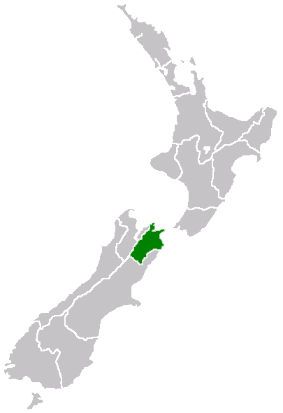
Marlborough_nz_location.png (۴۰۵ × ۵۹۰ پیکسل، اندازهٔ پرونده: ۷ کیلوبایت، نوع MIME پرونده: image/png)
این پرونده در ویکیانبار موجود است. محتویات صفحهٔ توصیف آن در زیر نمایش داده میشود. |
Region of New Zealand, position on the map
| |
این اثر توسط پدیدآور آن، Furius در ویکیانبار project، به مالکیت عمومی درآمده است. این مربوط به تمام جهان است. در این مواردی که قانوناً امکانپذیر نیست: |
تاریخچهٔ پرونده
روی تاریخ/زمانها کلیک کنید تا نسخهٔ مربوط به آن هنگام را ببینید.
| تاریخ/زمان | بندانگشتی | ابعاد | کاربر | توضیح | |
|---|---|---|---|---|---|
| کنونی | ۲۷ آوریل ۲۰۰۵، ساعت ۰۷:۴۰ | | ۴۰۵ در ۵۹۰ (۷ کیلوبایت) | Domie~commonswiki | Region of New Zealand, position on the map {{PD}} Category:Maps of New Zealand |
کاربرد پرونده
این پرونده در هیچ صفحهای به کار نرفته است.
کاربرد سراسری پرونده
ویکیهای دیگر زیر از این پرونده استفاده میکنند:
- کاربرد در en.wikipedia.org
- Port Gore
- Kenepuru Sound
- Cape Campbell
- Tapuae-o-Uenuku
- Long Island (Marlborough)
- RNZAF Base Woodbourne
- Fairy Bay
- Tawero Point
- Allports Island
- Amerikiwhati Island
- Anatakupu Island
- Wharanui
- Template:Marlborough-geo-stub
- Moenui
- Cape Jackson, New Zealand
- Penzance Bay
- Maungatapu
- Koromiko, New Zealand
- West Head
- Blumine Island
- Wards Pass
- Rangitoto Islands
- Chetwode Islands
- Marlborough Sounds Important Bird Areas
- Forsyth Island (New Zealand)
- Dillon Cone
- Whangamoa Saddle
- Bryant Range
- Burleigh, New Zealand
- Croisilles Harbour
- Kaikoura County
- Marlborough County
- Bird Island (Marlborough)
- Bottle Rock
- Budges Island
- Brown River (Marlborough)
- کاربرد در fi.wikipedia.org
- کاربرد در gd.wikipedia.org
- کاربرد در hi.wikipedia.org
- کاربرد در ja.wikipedia.org
- کاربرد در ko.wikipedia.org
- کاربرد در ms.wikipedia.org
- کاربرد در nn.wikipedia.org
- کاربرد در pl.wikipedia.org
- کاربرد در ru.wikipedia.org
- کاربرد در sh.wikipedia.org
- کاربرد در simple.wikipedia.org
- کاربرد در sv.wikipedia.org
- کاربرد در uk.wikipedia.org
- کاربرد در ur.wikipedia.org
نمایش استفادههای سراسری از این پرونده.