پرونده:NewZealand.A2002296.2220.250m North Island crop.jpg
اندازهٔ این پیشنمایش: ۴۲۳ × ۵۹۹ پیکسل. کیفیتهای دیگر: ۱۶۹ × ۲۴۰ پیکسل | ۳۳۹ × ۴۸۰ پیکسل | ۵۴۳ × ۷۶۸ پیکسل | ۷۲۳ × ۱٬۰۲۴ پیکسل | ۲٬۳۸۰ × ۳٬۳۶۸ پیکسل.
پروندهٔ اصلی (۲٬۳۸۰ × ۳٬۳۶۸ پیکسل، اندازهٔ پرونده: ۱٬۰۰۸ کیلوبایت، نوع MIME پرونده: image/jpeg)
این پرونده در ویکیانبار موجود است. محتویات صفحهٔ توصیف آن در زیر نمایش داده میشود. |
خلاصه
| توضیح |
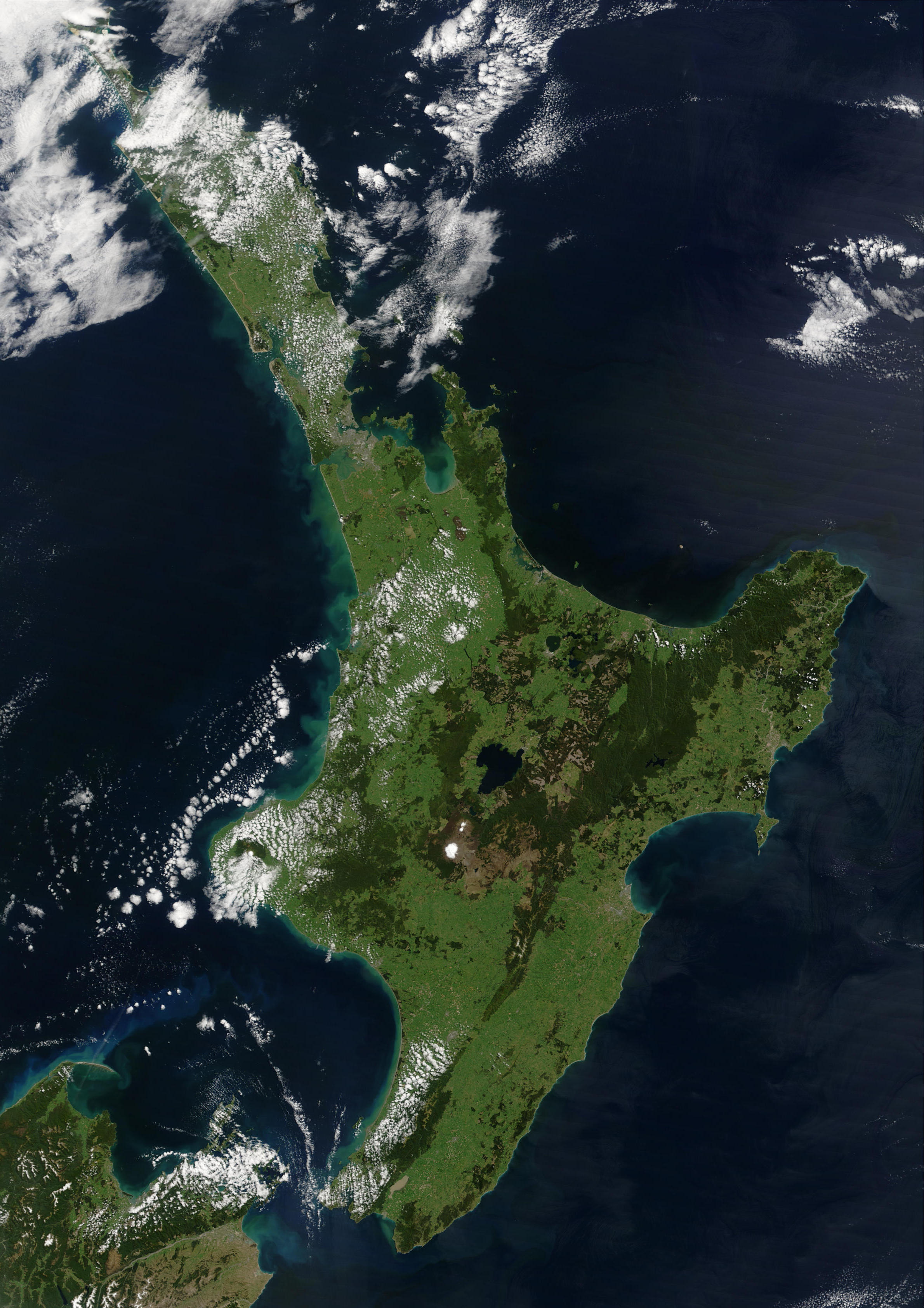
English: This satellite image of New Zealand's North Island has been cropped from an image of both of New Zealand's main islands.
"This stunning true-color image provides a rare, cloud-free look at the island nation of New Zealand, including most of its North and South Islands. This scene was acquired by the Moderate Resolution Imaging Spectroradiometer (MODIS), flying aboard NASA’s Terra satellite, on October 23, 2002. New Zealand is situated in the South Pacific Ocean, roughly 2,000 km (1,250 miles) southeast of Australia. Wellington, the capital of New Zealand, is located on the southern tip of the North Island, looking across Cook Strait toward South Island." |
||
| تاریخ | عکسبرداریشده در ۲۳ اکتبر ۲۰۰۲ | ||
| منبع | https://lance-modis.eosdis.nasa.gov/cgi-bin/imagery/single.cgi?image=NewZealand.A2002296.2220.250m.jpg (image link); see also https://earthobservatory.nasa.gov/images/3101/new-zealand and https://visibleearth.nasa.gov/view.php?id=62892 | ||
| پدیدآور | NASA/GSFC/MODIS Land Rapid Response Team, Jacques Descloitres | ||
| دیگر نسخهها |
|

اجازهنامه
| این پرونده در مالکیت عمومی قرار دارد چرا که توسط ناسا ایجاد شده است. سیاست حق تکثیر ناسا بیان میکند که «مواد ناسا با حق تکثیر محافظت نمیشوند، مگراینکه ذکر شده باشد». (Template:PD-USGov، صفحهٔ سیاست حق تکثیر ناسا یا سیاست جیپیال استفاده از تصاویر را ببینید.) | ||
 |
هشدارها:
|
تاریخچهٔ پرونده
روی تاریخ/زمانها کلیک کنید تا نسخهٔ مربوط به آن هنگام را ببینید.
| تاریخ/زمان | بندانگشتی | ابعاد | کاربر | توضیح | |
|---|---|---|---|---|---|
| کنونی | ۳۰ نوامبر ۲۰۱۱، ساعت ۱۸:۲۵ | | ۲٬۳۸۰ در ۳٬۳۶۸ (۱٬۰۰۸ کیلوبایت) | Andkore |
کاربرد پرونده
صفحهٔ زیر از این تصویر استفاده میکند:
کاربرد سراسری پرونده
ویکیهای دیگر زیر از این پرونده استفاده میکنند:
- کاربرد در af.wikipedia.org
- کاربرد در an.wikipedia.org
- کاربرد در ar.wikipedia.org
- کاربرد در ary.wikipedia.org
- کاربرد در arz.wikipedia.org
- کاربرد در ast.wikipedia.org
- کاربرد در az.wikipedia.org
- کاربرد در ban.wikipedia.org
- کاربرد در br.wikipedia.org
- کاربرد در ceb.wikipedia.org
- کاربرد در el.wikipedia.org
- کاربرد در en.wikipedia.org
- کاربرد در es.wikipedia.org
- کاربرد در eu.wikipedia.org
- کاربرد در ga.wikipedia.org
- کاربرد در gd.wikipedia.org
- کاربرد در he.wikipedia.org
- کاربرد در hu.wikipedia.org
- کاربرد در hy.wikipedia.org
- کاربرد در kab.wikipedia.org
- کاربرد در kk.wikipedia.org
- کاربرد در lv.wikipedia.org
- کاربرد در mk.wikipedia.org
- کاربرد در ms.wikipedia.org
- کاربرد در no.wikipedia.org
- کاربرد در pl.wikipedia.org
- کاربرد در pnb.wikipedia.org
- کاربرد در pt.wikipedia.org
- کاربرد در simple.wikipedia.org
- کاربرد در sl.wikipedia.org
- کاربرد در sr.wikipedia.org
- کاربرد در ta.wikipedia.org
- کاربرد در tk.wikipedia.org
- کاربرد در uk.wikipedia.org
- کاربرد در ur.wikipedia.org
- کاربرد در www.wikidata.org
- کاربرد در zh-yue.wikipedia.org