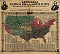
پرونده:Reynolds's Political Map of the United States 1856.jpg

اندازهٔ این پیشنمایش: ۶۶۱ × ۶۰۰ پیکسل. کیفیتهای دیگر: ۲۶۵ × ۲۴۰ پیکسل | ۵۲۹ × ۴۸۰ پیکسل | ۸۴۶ × ۷۶۸ پیکسل | ۱٬۱۲۸ × ۱٬۰۲۴ پیکسل | ۲٬۲۵۷ × ۲٬۰۴۸ پیکسل | ۷٬۸۱۳ × ۷٬۰۹۰ پیکسل.
پروندهٔ اصلی (۷٬۸۱۳ × ۷٬۰۹۰ پیکسل، اندازهٔ پرونده: ۱۹٫۷۶ مگابایت، نوع MIME پرونده: image/jpeg)
تاریخچهٔ پرونده
روی تاریخ/زمانها کلیک کنید تا نسخهٔ مربوط به آن هنگام را ببینید.
| تاریخ/زمان | بندانگشتی | ابعاد | کاربر | توضیح | |
|---|---|---|---|---|---|
| کنونی | ۱۶ اوت ۲۰۲۳، ساعت ۱۸:۲۹ |  | ۷٬۸۱۳ در ۷٬۰۹۰ (۱۹٫۷۶ مگابایت) | Jengod | Autotune so brighter and easier to read |
| ۲۲ آوریل ۲۰۱۶، ساعت ۰۷:۲۸ |  | ۷٬۸۱۳ در ۷٬۰۹۰ (۳۵٫۲۷ مگابایت) | Khamar | Original improved in Adobe Photoshop by removing white strip through center where left and right sides of map join, removing some dark and white stripes from image, and nudging some of the text and lines back into alignment preserving as much of the ma... | |
| ۱۷ دسامبر ۲۰۱۲، ساعت ۰۱:۴۰ |  | ۷٬۸۲۸ در ۷٬۰۹۰ (۱۶٫۵۶ مگابایت) | T3hBra1nWa5her | Higher resolution version from the [http://memory.loc.gov/cgi-bin/query/h?ammem/gmd:@field(NUMBER+@band(g3701e+ct000604)) Library of Congress Geography and Map Division Washington]. | |
| ۱ اوت ۲۰۰۸، ساعت ۱۳:۱۵ |  | ۲٬۰۰۰ در ۱٬۷۳۶ (۷۰۹ کیلوبایت) | Bdamokos | {{Information |Description={{en|US map 1856 shows free and slave states and populations; this is "Reynolds's Political Map of the United States" (1856) from Library of Congress collection[http://lcweb2.loc.gov/ammem/aaohtml/exhibit/aopart3b.html] [[:en |
کاربرد پرونده
صفحهٔ زیر از این تصویر استفاده میکند:
کاربرد سراسری پرونده
ویکیهای دیگر زیر از این پرونده استفاده میکنند:
- کاربرد در ar.wikipedia.org
- کاربرد در ca.wikipedia.org
- کاربرد در de.wikipedia.org
- کاربرد در en.wikipedia.org
- کاربرد در en.wikiquote.org
- کاربرد در es.wikipedia.org
- کاربرد در fi.wikipedia.org
- کاربرد در fr.wikipedia.org
- کاربرد در he.wikipedia.org
- کاربرد در hu.wikipedia.org
- کاربرد در id.wikipedia.org
- کاربرد در it.wikipedia.org
- کاربرد در ja.wikipedia.org
- کاربرد در ko.wikipedia.org
- کاربرد در no.wikipedia.org
- کاربرد در pl.wikipedia.org
- کاربرد در pt.wikipedia.org
- کاربرد در ro.wikipedia.org
- کاربرد در ru.wikipedia.org
- کاربرد در sh.wikipedia.org
- کاربرد در simple.wikipedia.org
نمایش استفادههای سراسری از این پرونده.