پرونده:Riparian strip.jpg
تفکیکپذیری بالاتری در دسترس نیست.
Riparian_strip.jpg (۶۵۵ × ۴۴۱ پیکسل، اندازهٔ پرونده: ۵۹ کیلوبایت، نوع MIME پرونده: image/jpeg)
این پرونده در ویکیانبار موجود است. محتویات صفحهٔ توصیف آن در زیر نمایش داده میشود. |
| مختصات شیء | | محل قرارگیری این نگاره و سایر نگارهها در: نقشهٔ شهری باز |
|---|
| توضیح |
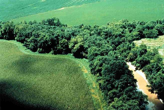
English: Riparian strip on a Lake Erie tributary. Location is the northeastern corner of Van Buren Township, Putnam County, Ohio, United States, east of the village of Belmore; this is the confluence of Yellow Creek and a tiny unnamed run. |
|||
| تاریخ | تاریخ نامعلوم | |||
| منبع | [1] (context) | |||
| پدیدآور | U.S. Department of Agriculture | |||
| اجازهنامه (استفادهٔ مجدد از این پرونده) |
|

![[1]](https://web.archive.org/web/20051220220554/http://www.oh.nrcs.usda.gov/programs/Lake_Erie_Buffer/images/riparian_putnam_co.jpg)
تاریخچهٔ پرونده
روی تاریخ/زمانها کلیک کنید تا نسخهٔ مربوط به آن هنگام را ببینید.
| تاریخ/زمان | بندانگشتی | ابعاد | کاربر | توضیح | |
|---|---|---|---|---|---|
| کنونی | ۲۸ ژوئیهٔ ۲۰۰۵، ساعت ۲۲:۲۹ | | ۶۵۵ در ۴۴۱ (۵۹ کیلوبایت) | Duk | Riparian strip, Putnam County, Ohio, Lake Erie tributary. {{PD-USGov-USDA}} source: http://www.oh.nrcs.usda.gov/programs/Lake_Erie_Buffer/images/riparian_putnam_co.jpg en:Riparian strips |
کاربرد پرونده
صفحههای زیر از این تصویر استفاده میکنند:
کاربرد سراسری پرونده
ویکیهای دیگر زیر از این پرونده استفاده میکنند:
- کاربرد در an.wikipedia.org
- کاربرد در ar.wikipedia.org
- کاربرد در be.wikipedia.org
- کاربرد در bn.wikipedia.org
- کاربرد در bs.wikipedia.org
- کاربرد در ca.wikipedia.org
- کاربرد در cs.wikipedia.org
- کاربرد در cy.wikipedia.org
- کاربرد در en.wikipedia.org
- کاربرد در en.wiktionary.org
- کاربرد در eo.wikipedia.org
- کاربرد در es.wikipedia.org
- کاربرد در eu.wikipedia.org
- کاربرد در fi.wikipedia.org
- کاربرد در fr.wikipedia.org
- کاربرد در gl.wikipedia.org
- کاربرد در id.wikipedia.org
- کاربرد در it.wikipedia.org
- کاربرد در ja.wikipedia.org
- کاربرد در ka.wikipedia.org
- کاربرد در ko.wikipedia.org
- کاربرد در nl.wikipedia.org
- کاربرد در oc.wikipedia.org
- کاربرد در pt.wikipedia.org
- کاربرد در ru.wikipedia.org
- کاربرد در sh.wikipedia.org
- کاربرد در sv.wikipedia.org
- کاربرد در tt.wikipedia.org
- کاربرد در uk.wikipedia.org
- کاربرد در www.wikidata.org
- کاربرد در zh.wikipedia.org