پرونده:SG-Settlements.png

اندازهٔ این پیشنمایش: ۸۰۰ × ۵۸۰ پیکسل. کیفیتهای دیگر: ۳۲۰ × ۲۳۲ پیکسل | ۶۴۰ × ۴۶۴ پیکسل | ۱٬۰۲۴ × ۷۴۲ پیکسل | ۱٬۲۸۰ × ۹۲۸ پیکسل | ۲٬۵۶۰ × ۱٬۸۵۶ پیکسل | ۳٬۷۰۲ × ۲٬۶۸۴ پیکسل.
پروندهٔ اصلی (۳٬۷۰۲ × ۲٬۶۸۴ پیکسل، اندازهٔ پرونده: ۴۱۹ کیلوبایت، نوع MIME پرونده: image/png)
این پرونده در ویکیانبار موجود است. محتویات صفحهٔ توصیف آن در زیر نمایش داده میشود. |
خلاصه
| توضیح |
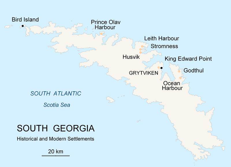
English: Map of South Georgia Island (Settlements) published by the author Apcbg. |
| تاریخ | |
| منبع | اثر شخصی |
| پدیدآور | Apcbg |
اجازهنامه
من، صاحب حقوق قانونی این اثر، به این وسیله این اثر را تحث اجازهنامهٔ ذیل منتشر میکنم:

|
اجازهٔ کپی، پخش و/یا تغییر این سند تحت شرایط مجوز مستندات آزاد گنو، نسخهٔ ۱٫۲ یا هر نسخهٔ بعدتری که توسط بنیاد نرمافزار آزاد منتشر شده؛ بدون بخشهای ناوردا (نامتغیر)، متون روی جلد، و متون پشت جلد، اعطا میشود. یک کپی از مجوز در بخشی تحت عنوان مجوز مستندات آزاد گنو ضمیمه شده است. |
| این پرونده با اجازهنامهٔ کریتیو کامانز Attribution-Share Alike 3.0 سازگار نشده منتشر شده است. | ||
| ||
| این برچسب مجوز بهعنوان بخشی از روزآمدسازی مجوز GFDL، به این پرونده افزوده شد. |
تاریخچهٔ پرونده
روی تاریخ/زمانها کلیک کنید تا نسخهٔ مربوط به آن هنگام را ببینید.
| تاریخ/زمان | بندانگشتی | ابعاد | کاربر | توضیح | |
|---|---|---|---|---|---|
| کنونی | ۱۸ نوامبر ۲۰۰۷، ساعت ۲۰:۲۶ | | ۳٬۷۰۲ در ۲٬۶۸۴ (۴۱۹ کیلوبایت) | Apcbg | {{Information |Description=Map of South Georgia Island (Settlements) published by the author Apcbg. |Source=self-made |Date=18 November 2007 |Author= Apcbg }} == Licensing == {{self|GFDL}} |
| ۱۸ نوامبر ۲۰۰۷، ساعت ۲۰:۱۶ |  | ۳٬۷۰۲ در ۲٬۶۸۴ (۴۱۹ کیلوبایت) | Apcbg | {{Information |Description=Map of South Georgia Island (Settlements) published by the author Apcbg. |Source=self-made |Date=18 November 2007 |Author= Apcbg }} == Licensing == {{self|GFDL}} | |
| ۱۸ نوامبر ۲۰۰۷، ساعت ۱۸:۲۳ |  | ۳٬۷۰۲ در ۲٬۶۸۴ (۴۱۹ کیلوبایت) | Apcbg | {{Information |Description=Map of South Georgia Island (Settlements) published by the author Apcbg. |Source=self-made |Date=18 November 2007 |Author= Apcbg }} == Licensing == {{self|GFDL}} | |
| ۷ اکتبر ۲۰۰۷، ساعت ۱۱:۰۰ |  | ۲٬۹۶۲ در ۱٬۹۵۲ (۱۶۴ کیلوبایت) | Apcbg | {{Information |Description=Map of South Georgia Island (Settlements) published by the author Apcbg. |Source=self-made |Date=7 October 2007 |Author= Apcbg }} == Licensing == {{self|GFDL}} | |
| ۷ اکتبر ۲۰۰۷، ساعت ۱۰:۳۲ |  | ۲٬۹۶۲ در ۱٬۹۵۲ (۱۶۴ کیلوبایت) | Apcbg | {{Information |Description=Map of South Georgia Island (Settlements) published by the author Apcbg. |Source=self-made |Date=7 October 2007 |Author= Apcbg }} == Licensing == {{self|GFDL}} | |
| ۷ اکتبر ۲۰۰۷، ساعت ۰۸:۴۲ |  | ۲٬۹۶۲ در ۱٬۹۵۲ (۱۶۳ کیلوبایت) | Apcbg | {{Information |Description=Map of South Georgia Island (Settlements) published by the author Apcbg. |Source=self-made |Date=7 October 2007 |Author= Apcbg }} == Licensing == {{self|GFDL}} | |
| ۵ اکتبر ۲۰۰۷، ساعت ۲۱:۵۵ |  | ۲٬۹۶۲ در ۱٬۹۵۲ (۱۶٫۵۷ مگابایت) | Apcbg | {{Information |Description=Map of South Georgia Island (Settlements) published by the author Apcbg. |Source=self-made |Date=5 October 2007 |Author= Apcbg }} == Licensing == {{self|GFDL}} | |
| ۵ اکتبر ۲۰۰۷، ساعت ۲۱:۳۶ |  | ۲٬۹۶۲ در ۱٬۹۵۲ (۲۱۱ کیلوبایت) | Apcbg | {{Information |Description=Map of South Georgia Island (Settlements) published by the author Apcbg. |Source=self-made |Date=5 October 2007 |Author= Apcbg }} == Licensing == {{self|GFDL}} |
کاربرد پرونده
صفحههای زیر از این تصویر استفاده میکنند:
کاربرد سراسری پرونده
ویکیهای دیگر زیر از این پرونده استفاده میکنند:
- کاربرد در af.wikipedia.org
- کاربرد در ar.wikipedia.org
- کاربرد در bg.wikipedia.org
- کاربرد در bs.wikipedia.org
- کاربرد در ca.wikipedia.org
- کاربرد در de.wikipedia.org
- کاربرد در el.wikipedia.org
- کاربرد در en.wikipedia.org
- South Georgia and the South Sandwich Islands
- Grytviken
- South Georgia
- King Edward Point
- Bird Island, South Georgia
- History of South Georgia and the South Sandwich Islands
- Leith Harbour
- Solveig Gunbjørg Jacobsen
- Prince Olav Harbour
- Godthul
- Ocean Harbour
- Invasion of South Georgia
- Reindeer in South Georgia
- List of settlements in South Georgia and the South Sandwich Islands
- کاربرد در eo.wikipedia.org
- کاربرد در es.wikipedia.org
- کاربرد در et.wikipedia.org
- کاربرد در fi.wikipedia.org
- کاربرد در fr.wikipedia.org
- کاربرد در fy.wikipedia.org
- کاربرد در gd.wikipedia.org
- کاربرد در gl.wikipedia.org
- کاربرد در he.wikipedia.org
- کاربرد در hu.wikipedia.org
- کاربرد در id.wikipedia.org
- کاربرد در incubator.wikimedia.org
- کاربرد در is.wikipedia.org
- کاربرد در it.wikipedia.org
نمایش استفادههای سراسری از این پرونده.